Instrução
Crie pontos nas interseções de linha no ArcGIS Pro
Resumo
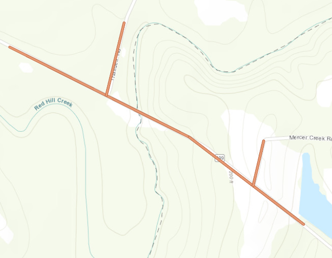
In ArcGIS Pro, points can be created on line intersections on a map. This is useful in some workflows such as marking intersections on a road network of a town. The workflow involves combining two different tools, Unsplit Lines and Intersect. This article describes how to add points on line intersections. In the example, points are created on road intersections along a freeway (note the freeway marked in red on the map below).
Procedimento
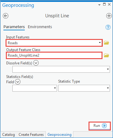
- Run the Unsplit Lines tool on the line layer to merge coincident endpoints of lines so they do not count as intersections.
- Navigate to the Geoprocessing pane. Click Toolboxes >Data Management Tools > Features > Unsplit Lines.
- In the Unsplit Lines geoprocessing pane, for Input Features, select the line layer to merge.
- For Output Feature Class, specify a name and location for the output line layer.
- Click Run.
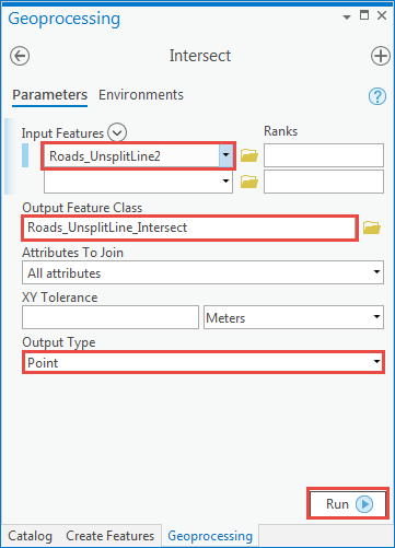
- Run the Intersect tool on the output line layer from Step 1 to create points at the intersections.
- Navigate to the Geoprocessing pane. Click Toolboxes >Analysis Tools > Overlays > Intersect.
- In the Intersect geoprocessing pane, for Input Features, select the line layer output from step 1.
- For Output Feature Class, specify a name and location for the output point layer.
- For Output Type, select Point from the drop-down menu.
- Click Run.
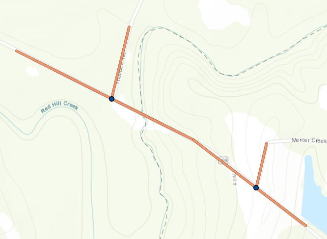
Points are created at the intersections, as shown on the map below.
ID do Artigo: 000025044
Obtenha suporte com IA
Resolva seu problema rapidamente com o chatbot de IA de suporte da Esri.


Informações Relacionadas
Descubra mais sobre este tema
Search for related information
Find training related to this topic
Explore ideas and give feedback
Obtenha ajuda de especialistas do ArcGIS
Comece a conversar agora