HOW TO
Create connection lines between two points
Summary
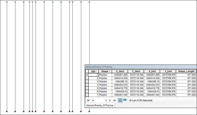
The instructions provided describe how to create connection lines between two points in ArcMap. For example, seismic lines data spreadsheet usually consists of start and end point locations, representing the seismic lines to be shot in a survey. In ArcMap, it is possible to generate a set of lines from these points using the XY To Line tool.
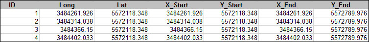
To ensure the lines that generated in ArcMap are accurately located, the attribute table must contain the latitude and longitude of the start and end point features, as illustrated in the example below.
Note:
Refer to How To: Calculate latitude and longitude for point features for instructions to extract the latitute and longitude values of point layers before using the XY To Line tool.
Procedure
Follow the steps below to create connection lines between two points on a map.
- Insert the XY data into ArcMap.
- Select the correct coordinate system and X and Y Fields.
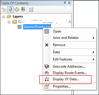
- Right-click the particular layer in the data table, and select Display XY Data.
- Select the X and Y values in the X and Y Fields.
- Click Edit to define a correct coordinate system.
- Click OK twice. The points are now added to the map as a layer in the Table of Contents.
- Save the points permanently.
- Right-click the event layer, and select Data > Export Data.
- Click the Browse button to select a location and name for the new file.
- Set the file type as shapefile or feature class.
- Click Save, and click OK.

- Go to ArcToolbox > Data Management Tools > Features > XY to Line.
- Using the new shapefile or feature class created in Step 2, enter in the Start X Field, Start Y Field, End X Field, and End Y Field of the table.
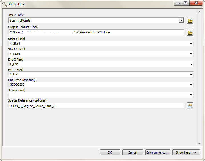
- Run the XY to Line tool.
Article ID: 000012092
- ArcMap
Get support with AI
Resolve your issue quickly with the Esri Support AI Chatbot.


Related Information
Discover more on this topic
Search for related information
Find training related to this topic
Explore ideas and give feedback
Get help from ArcGIS experts
Start chatting now