A to Z GIS | Explore this related guide, featuring updated terms and graphics and developed in coordination with Esri’s GIS Dictionary team.
Learn more about A to Z GIS
GIS Dictionary
Browse dictionary
universal polar stereographic
URL copiedShare URL
[coordinate systems]
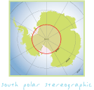
A projected coordinate system that covers all regions not included in the UTM coordinate system; that is, regions above 84 degrees north and below 80 degrees south. Its central point is either the north or south pole.