A to Z GIS | Explore this related guide, featuring updated terms and graphics and developed in coordination with Esri’s GIS Dictionary team.
Learn more about A to Z GIS
GIS Dictionary
Browse dictionary
projection
URL copiedShare URL
[data conversion]
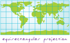
A geometric transformation of the earth's spherical or ellipsoidal surface onto a flat map surface—also known as a developable surface. A projection generally requires a systematic mathematical transformation of the earth's graticule of lines of longitude and latitude onto a plane. Every map projection distorts distance, area, shape, direction, or some combination thereof.
[data conversion]
The conversion of a spherical surface (a globe) to a flat map surface using one of many mathematical models.