操作方法
操作方法:使用 Site Scan Manager for ArcGIS 合并飞行
摘要
Instructions provided describe how to merge flights using Site Scan Manager for ArcGIS.
Oblique images can be used stand-alone or incorporated into the photogrammetry process to be included in an orthomosaic or model.
Nadir imagery is generally not sufficient to build an accurate point cloud of a site that contains vertical surfaces. By combining oblique and nadir imagery, a single point cloud or mesh of a structure and its surroundings can be generated.
Additionally, two or more surveys that overlap can be combined to cover a wider area, even if there is no oblique imagery used. All of this can be done directly from Site Scan for ArcGIS Manager’s Merge Flights feature.
过程
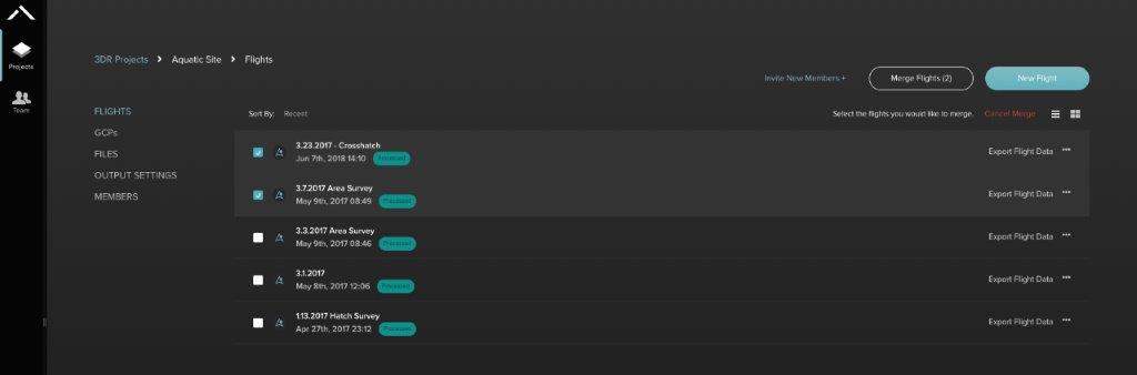
- Click the Projects tab and select the project that contains the flights to combine. Ensure that they were flown on the same site under similar lighting conditions and elevation. To cover a larger area on a single output file, ensure that the flights overlap each other.

- After selecting a project that contains multiple flights, click the Merge Flights button on the top right.

- Select the flights to merge in the project.
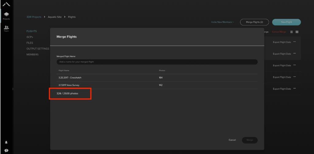
- Name the resulting merged flight.
- Click Merge.
- Notice that the Merge Flights dialog shows an image counter at the bottom. Make sure to stay within the 2,500 image limit.
- Wait for the merge to finish processing, after which, export the files as with any other flight in Site Scan for ArcGIS.
文章 ID: 000023031
获得人工智能支持
使用 Esri Support AI Chatbot 快速解决您的问题。


发现关于本主题的更多内容
Search for related information
Find training related to this topic
Explore ideas and give feedback
获取来自 ArcGIS 专家的帮助
立即开始聊天