HOW TO
Clip a random point feature within a polygon feature from a raster layer in ArcGIS Pro
Summary
Generating random points within a specified area is useful for analyzing spatial relationships and impact areas. Certain areas of a raster layer can be clipped for better spatial analysis and data visualization by converting it to a vector layer before clipping it using the Clip tool. This article provides a workflow on how to clip a random point feature within a polygon feature from a raster layer in ArcGIS Pro.
Procedure
- Open the ArcGIS Pro project.
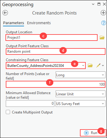
- Create a specified number of point features from the point feature layer using the Create Random Points tool.
- On the ribbon, click the Analysis tab. In the Geoprocessing group, click Tools.
- In the Geoprocessing pane, search for and click Create Random Points (Data Management Tools).
- In the Create Random Points pane, for Output Location, click Browse and specify a location for the output random point feature.
- For Output Point Feature Class, specify a name.
- For Constraining Feature Class, click the drop-down list and select the point feature layer.
- For Number of Points (value or field), specify the number of points to be randomly generated. In this example, 100 points are specified.
- Click Run.
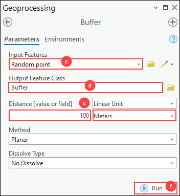
- Create a buffer with a specified distance for the point features using the Buffer tool.
- On the ribbon, click the Analysis tab. In the Geoprocessing group, click Tools.
- In the Geoprocessing pane, search for and click Buffer (Analysis Tools).
- In the Buffer pane, for Input Features, click the drop-down list and select the output point feature layer created in Step 2.
- For Output Feature Class, specify a name and location.
- For Distance [value or field], select Linear Unit from the drop-down list and specify the distance and the unit. In this example, 100 meters is specified.
- Click Run.
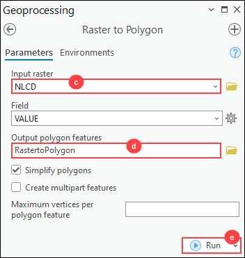
- Convert the raster layer to a polygon feature using the Raster to Polygon tool.
- On the ribbon, click the Analysis tab. In the Geoprocessing group, click Tools.
- In the Geoprocessing pane, search for and click Raster to Polygon (Conversion Tools).
- In the Raster to Polygon pane, for Input raster, click the drop-down list and select the raster layer.
- For Output polygon features, specify a name and location.
- Click Run.
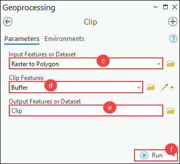
- Extract the buffer area that overlays within the polygon feature using the Clip tool.
- On the ribbon, click the Analysis tab. In the Geoprocessing group, click Tools.
- In the Geoprocessing pane, search for and click Clip (Analysis Tools).
- In the Clip pane, for Input Features or Dataset, click the drop-down list and select the polygon feature layer created in Step 4.
- For Clip Features, click the drop-down list and select the output feature layer created in Step 3.
- For Output Features or Dataset, specify a name and location.
- Click Run.
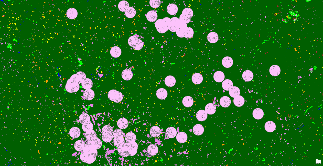
The clipped random point features from the raster data within the polygon layer are displayed on the map.
Article ID: 000033204
- ArcGIS Pro 3 1
- ArcGIS Pro 3 3
- ArcGIS Pro 3 2
Get support with AI
Resolve your issue quickly with the Esri Support AI Chatbot.


Related Information
Discover more on this topic
Search for related information
Find training related to this topic
Explore ideas and give feedback
Get help from ArcGIS experts
Start chatting now