A to Z GIS | Explore this related guide, featuring updated terms and graphics and developed in coordination with Esri’s GIS Dictionary team.
Learn more about A to Z GIS
GIS Dictionary
Browse dictionary
gnomonic projection
URL copiedShare URL
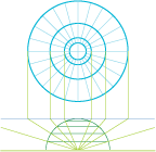
[map projections]
A planar projection, tangent to the earth at one point, projected from the center of the globe. All great circles appear as straight lines on this projection, so that the shortest distance between two points is a straight line. The gnomonic projection is useful in navigation. The gnomonic projection was used by Thales of Miletus, an ancient Greek astronomer and philosopher, to chart the heavens. It is possibly the oldest map projection.