A to Z GIS | Explore this related guide, featuring updated terms and graphics and developed in coordination with Esri’s GIS Dictionary team.
Learn more about A to Z GIS
GIS Dictionary
Browse dictionary
discrete raster
URL copiedShare URL
[data architecture, geography]
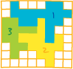
A raster that typically represents phenomena that have clear boundaries with attributes that are descriptions, classes, or categories. It is assumed that the phenomena represented by each value fills the entire area of its cell. Rasters representing land use, political boundaries, or ownership are examples of discrete rasters.