Frequently asked question
What is the difference between the three default layout grids?
Divides the map with lines of latitude and longitude based on the projection, scale and extent of the data frame. The intervals are labeled in Degree Minutes and Seconds.
Measured
Divides the map into a grid of map units by default, or into units of the projection set within the grids and graticule wizard.
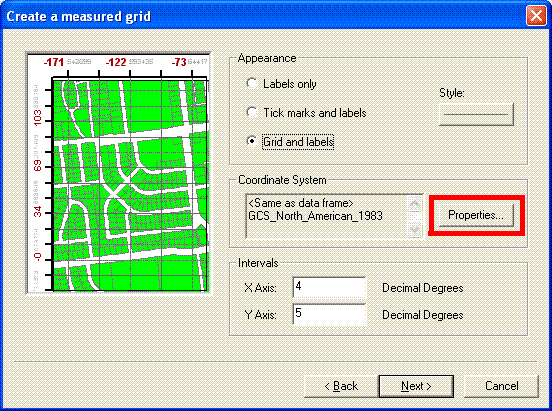
The intervals are labeled in the measured unit of the coordinate system set for the grid.
The intervals are labeled in the measured unit of the coordinate system set for the grid.
Reference
Divides the map into a grid for indexing. This grid draws independently of the projection, scale and extent of the map. The interval spacing is determined by the data frame size and the number of rows and columns. The tabs are labeled in ascending order from A in the column heading and 1 in the row heading or vice-versa.
The difference between a graticule or measured grid and a reference grid can be demonstrated by changing the scale or extent of the map. Zooming into the map causes the graticule and measured grid lines to diverge. The reference grid remains unchanged.
Article ID: 000008616
Software:
- ArcMap 8 x
- ArcMap 9 x
Receive notifications and find solutions for new or common issues
Get summarized answers and video solutions from our new AI chatbot.


Discover more on this topic
Search for related information
Find training related to this topic
Explore ideas and give feedback
Get help from ArcGIS experts
Download the Esri Support App