HOW TO
Load features of a specific area from a WFS service using the BBOX custom parameter in ArcGIS Pro
Summary
By specifying a bounding box, users can limit the data returned by the WFS service to only those features that fall within the defined geographic area. When working with large datasets, it is often inefficient to load all features from a WFS service. Using the BBOX parameter helps optimize performance by reducing the amount of data transferred from the WFS service.
Notes:
- Note that the On Demand Connection Mode is a dynamic way of limiting the loaded data from the WFS service to a specific area. The On Demand connection mode does only load the features that fall in the current map view. Zooming and panning in the map changes the area for which the features are requested from the WFS service.
Contrarily, the BBOX parameter is a static way of defining the requested area from the WFS service. On Demand Connection Mode and BBOX parameter are not compatible. To use BBOX parameter the Connection Mode must be set to Snapshot. - Note that a common issue is that not all feature of a WFS service within a bounding box can be displayed due to the number of features exceeding the number of features defined in the maximum features returned setting. This property limits the number of features that are added to the map. To avoid performance issues, the default value is set to 3000 features. This value can be increased manually in the WFS layer properties.
Procedure
In this specific example, a BBOX parameter is added to the following WFS service: https://sampleserver6.arcgisonline.com/arcgis/services/SampleWorldCities/MapServer/WFSServer
As described in the documentation, the BBOX parameter requires four values: minx, miny, maxx, maxy, which represent the minimum and maximum coordinates of the bounding box.
However, for this particular WFS service the coordinate system is WGS 1985, and therefore the BBOX parameter requires latitude and longitude input values.
In the context of WFS services, the use of x and y coordinates can vary depending on the service provider and the specific implementation. However typically:
- Latitude corresponds to the y-coordinate
- Longitude corresponds to the x-coordinate
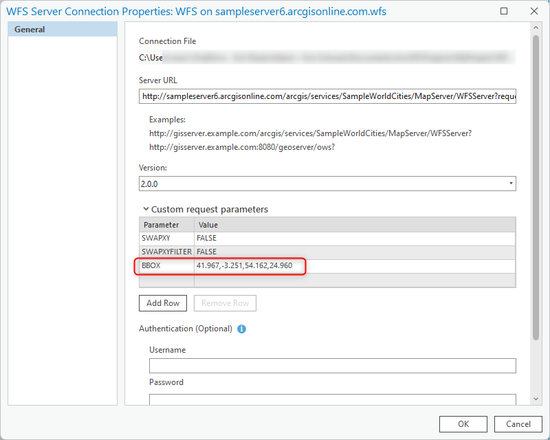
Therefore a valid BBOX value of central Europe is for example, 41.967, -3.251, 54.162, 24.960 (min_lat, min_long, max_lat, max_long)
In the WFS Server Connection Properties, expand the Custom request parameters and add the BBOX parameter and 41.967,-3.251,54.162,24.960 as its value.
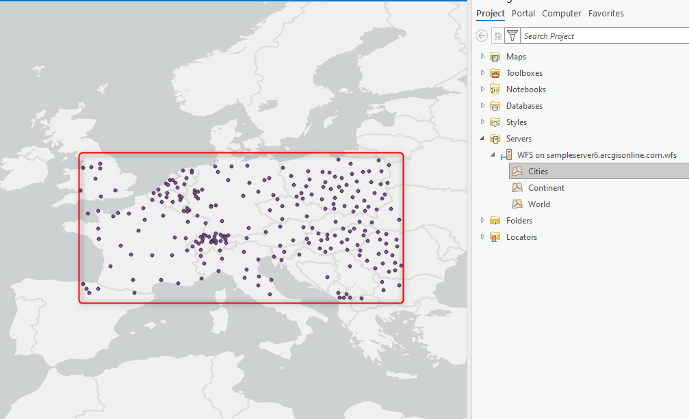
Note that WFS layers already in a map are not affected by this setting. Re-add the layer to the map for the BBOX parameters to apply.
As a result, only features within this bounding box are displayed.
Article ID: 000033758
- ArcGIS Pro
Get support with AI
Resolve your issue quickly with the Esri Support AI Chatbot.


Related Information
Discover more on this topic
Search for related information
Find training related to this topic
Explore ideas and give feedback
Get help from ArcGIS experts
Start chatting now