A to Z GIS | Explore this related guide, featuring updated terms and graphics and developed in coordination with Esri’s GIS Dictionary team.
Learn more about A to Z GIS
GIS Dictionary
Browse dictionary
symbol
URL copiedShare URL
[symbology]
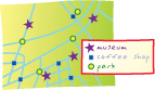
A graphic used to represent a geographic feature or class of features. Symbols can look like what they represent (trees, railroads, houses), or they can be abstract shapes (points, lines, polygons) or characters. Symbols are typically explained in a map legend.