A to Z GIS | Explore this related guide, featuring updated terms and graphics and developed in coordination with Esri’s GIS Dictionary team.
Learn more about A to Z GIS
GIS Dictionary
Browse dictionary
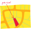
parcel
URL copiedShare URL
[surveying]
A piece or unit of land, defined by a series of measured straight or curved lines that connect to form a polygon. There are some implications of land ownership. Commonly also called a tract.
[surveying]
A group of features representing an area or volume of land or water. In the parcel fabric, a two-dimensional parcel is composed of a polygon feature and line and point features. The parcel polygon represents the land area, the parcel lines are COGO-enabled and store the boundary measurements, and the parcel points represent the parcel corners. A parcel can be used to represent rights, restrictions, or responsibilities. Parcels can also be used to model administrative boundaries or cadastral frameworks.