A to Z GIS | Explore this related guide, featuring updated terms and graphics and developed in coordination with Esri’s GIS Dictionary team.
Learn more about A to Z GIS
GIS Dictionary
Browse dictionary
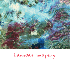
Landsat
URL copiedShare URL
[aerospace, remote sensing]
A series of polar-orbiting, earth-imaging satellites that collect multispectral imagery used for land cover and land use inventory, geological and mineralogical exploration, crop and forestry assessment, urban development, monitoring short- and long-term land cover change, and more. Developed jointly by NASA and the United States Geological Survey (USGS), Landsat satellites provide a continuous record of medium-resolution coverage of the earth dating back to 1972; the revisit rate is 16 days.