A to Z GIS | Explore this related guide, featuring updated terms and graphics and developed in coordination with Esri’s GIS Dictionary team.
Learn more about A to Z GIS
GIS Dictionary
Browse dictionary
image division
URL copiedShare URL
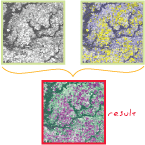
[image processing]
A digital image processing technique for increasing the contrast between features in an image by dividing the pixel values in the image by the values of corresponding pixels in a second image. Image division is normally used to identify concentrations of vegetation.