HOW TO
Add a geospatial PDF file to Collector for ArcGIS
Summary
A geospatial PDF file contains spatial attributes such as coordinates, azimuth, and the coordinate system. So, it is possible to use the data to measure distances, track locations, and run geoprocessing operations in a mapping software or application. However, it is not possible to upload a geospatial PDF file directly to Collector for ArcGIS for data collection. The PDF file must be converted into a raster format and published as a tile package before it is used in Collector for ArcGIS.
Note:
The functionalities of ArcGIS Collector, ArcGIS Explorer, and ArcGIS Tracker are now available in ArcGIS Field Maps. There are no new capabilities planned for these apps—all future updates will be focused on Field Maps. Migration is recommended. See ArcGIS Blog: Migrate to Field Maps for more information.
Procedure
Use the following steps to add a geospatial PDF file to Collector for ArcGIS:
- In ArcMap, convert a geospatial PDF file to a GeoTIFF file using the PDF to TIFF tool.
Note:
Using the PDF to TIFF tool, a PDF file is converted to a Tagged Image File Format (TIFF) file, while a geospatial PDF file is converted to a GeoTIFF file.
Note:
If the PDF file is a non-geospatial PDF file, georeference the PDF file using either the method described in ArcMap: Georeferencing a raster to a vector or ArcMap: Georeferencing a raster to another raster.
- Export the GeoTIFF file as a tile package (.tpk file) to ArcGIS Online using the steps outlined in ArcMap: How to create a tile package. For more information on sharing tile packages, refer to ArcGIS Blog: Using tile packages for publishing hosted tile layers.
- In ArcGIS Online, open the item details page and click Publish to publish the tile package as a hosted tile layer.
Note:
Only Administrator and Publisher roles have the privileges to publish items in ArcGIS Online.
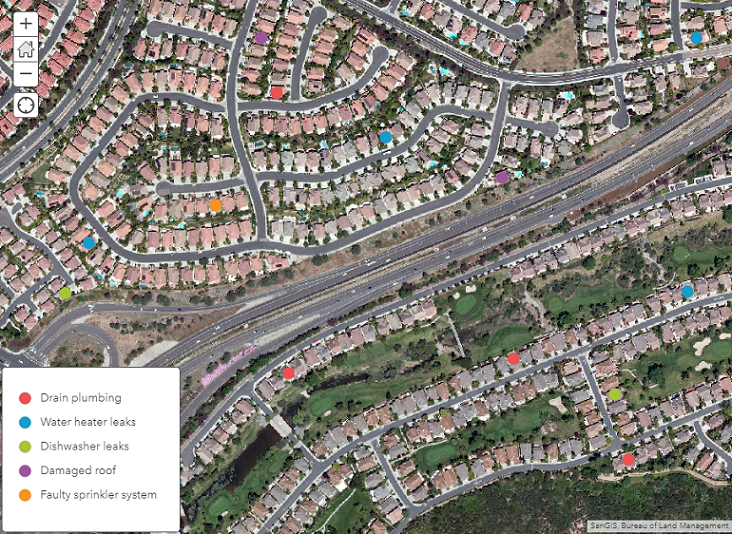
- Add the hosted tile layer to a web map. The image below shows the exported tile package when added to a web map as a layer.
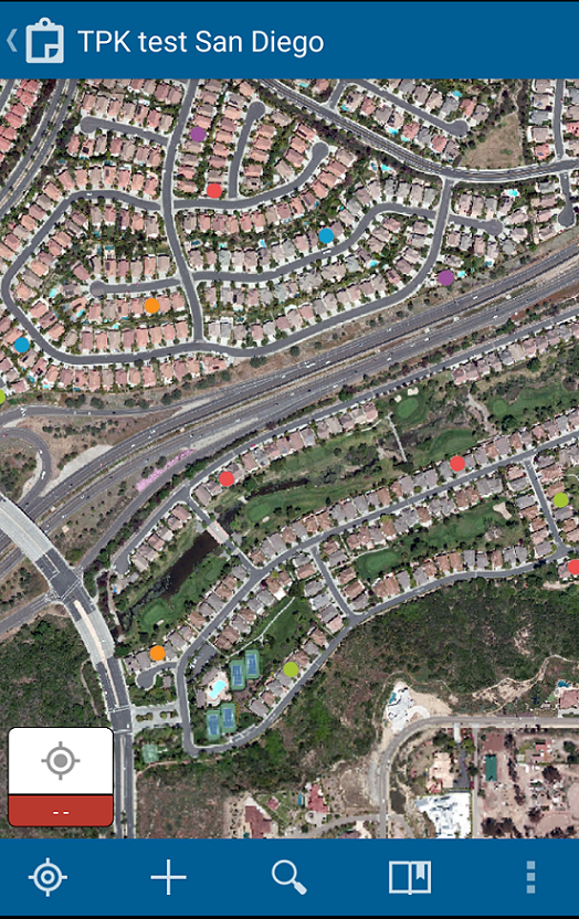
- Open Collector for ArcGIS and view the web map containing the hosted tile layer.
Note:
If the web map does not appear in Collector for ArcGIS, refer to Problem: Unable to view a web map in Collector for ArcGIS and ArcGIS Online: Set map options for apps.
Article ID: 000021054
- ArcGIS Collector
- ArcGIS Desktop
- ArcGIS Online
Get support with AI
Resolve your issue quickly with the Esri Support AI Chatbot.


Related Information
Discover more on this topic
Search for related information
Find training related to this topic
Explore ideas and give feedback
Get help from ArcGIS experts
Start chatting now