PROBLEM
Labels are hidden for nearby features in ArcGIS Online Map Viewer
Description
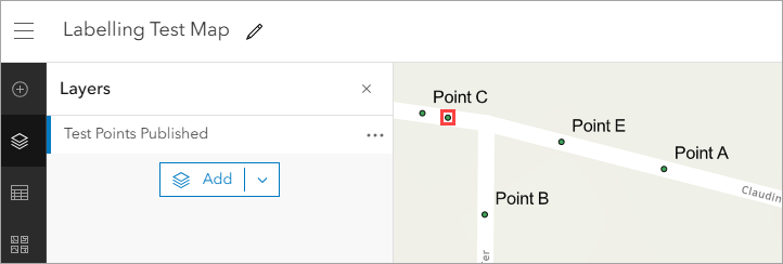
In ArcGIS Online Map Viewer, labels are used to convey information about features. Refer to ArcGIS Online: Configure labels (Map Viewer) for more information. When features are in close proximity, labels are hidden by default, even when zoomed to the maximum extent and after adjusting label placement. The web map below shows an example where the Point D label is hidden as it is located near Point C.
Cause
This is expected behavior in ArcGIS Online Map Viewer. Labels for nearby features are hidden and displayed differently due to compatibility issues with label placement properties.
Solution or Workaround
Use one of the following options to display hidden labels on a web map in ArcGIS Online Map Viewer:
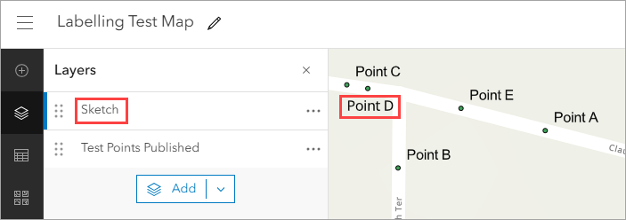
Use a sketch feature as the label
- Open the web map in ArcGIS Online Map Viewer.
- Create a sketch layer. Refer to ArcGIS Online: Create a sketch layer for instructions.
- Select Text from the sketch tools to add a text feature for the hidden labels. Refer to ArcGIS Online: Add text for instructions.
The image below shows the newly created sketch feature displayed as the label on the web map in ArcGIS Online Map Viewer.
Use an annotation tile layer to display the labels
Note:
This workflow consumes credits depending on the number of tiles generated. Refer to ArcGIS Online: Understand credits for more information.
Convert the label to annotation using the Convert Labels To Annotation tool in ArcGIS Pro and publish the layer as a hosted tile layer to ArcGIS Online. Refer to the second workaround in Problem: Label placement properties in ArcGIS Pro are not retained in ArcGIS Online Map Viewer for instructions. In Step 4, before publishing the annotation layer as a tile layer, in the Share As Web Layer pane, on the Configuration tab, under the Tiling Scheme section, drag the slider for Levels of Detail to set the map scales for the tiles.
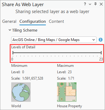
Note:
In ArcGIS Pro 3.4, in the Share As Web Layer pane, on the Configuration tab, expand Options and click Cache locally before publishing the layer as a tile layer.
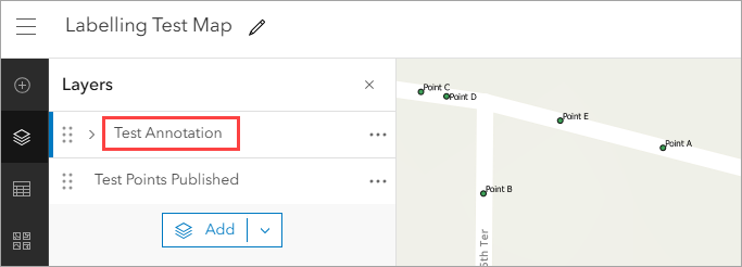
The image below shows the annotation tile layer displaying the label on the web map in ArcGIS Online Map Viewer.
Article ID: 000034343
- ArcGIS Online
- ArcGIS Pro 3 3
- ArcGIS Pro 3 2
- ArcGIS Pro 3 4
Get support with AI
Resolve your issue quickly with the Esri Support AI Chatbot.


Related Information
Discover more on this topic
Search for related information
Find training related to this topic
Explore ideas and give feedback
Get help from ArcGIS experts
Start chatting now