Frequently asked question
What are the best practices to accentuate labels using label classes?
Labeling involves attaching descriptive text to elements on a map, and these labels can be positioned dynamically using label classes to restrict labels to features or to specify label fields, symbols, scale ranges, label priorities, and sets of label placement options for groups of labels. Refer to ArcGIS Pro: Labeling basics for more information. Accentuating labeling with label classes defines the distinct labeling characteristics for elements within the same layer.
The following are a few best practices to consider when labeling.
Color
Labels can be accentuated using different colors and text formatting tags. Labels can be colored using different types of script languages such as Arcade, Python, and VBScript. For example, here is an Arcade expression to color a label, "<CLR <colorName> = '255'>" + "Text" + "</CLR>". Refer to ArcGIS Pro: Specify text for labels and ArcGIS Pro: Color (RGB) for more information.
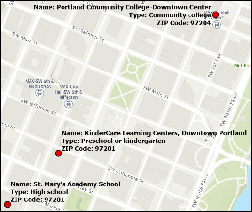
Multiline labels can be colored differently. For example, the information on education institutions’ names, types, and ZIP Codes can be accentuated using different colors for each detail. The image below shows the map with information in the same font color, without accentuation.
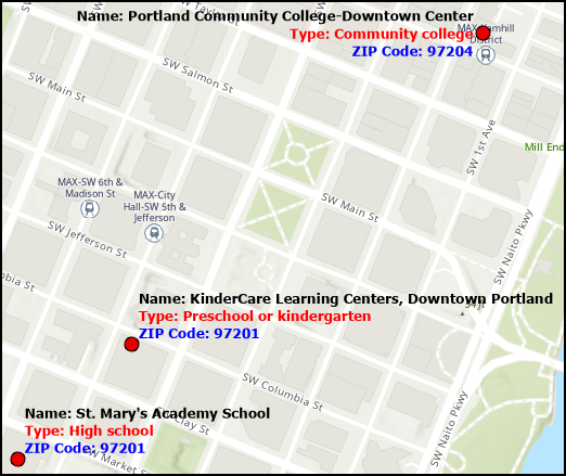
Using the ArcGIS Arcade text formatting tags, each line in the label of the education institutions is accentuated. For more information, refer to How to: Apply different colors for conditioned labeling in ArcGIS Pro. The image below displays the map with labeling information accentuated.
Scale
The size of text symbols used for labeling can be adjusted across their visible scale range to reduce visual density at smaller scales while retaining an appropriate relative size at larger scales.
Setting a minimum and maximum scale for labels can improve the map's overall performance during redrawing. This augmentation facilitates more responsive panning and zooming, as labels exclusively materialize within the scale range where it is most useful.
Designate both the minimum and maximum scales within the Visibility Range group on the Labeling tab or the Visibility Range tab within the Label Class pane. If no scale is specified, the labels inherit the same scale range as the feature layer. For more information, refer to ArcGIS Pro: Set scale ranges for label classes and Problem: Labels are not retained in the layout view in ArcGIS Pro.
Placement
By default, the label engine inherently manages conflicts between labels and prevents overlap. There is an option to place overlapping labels by ensuring the layer or label class is positioned at the highest priority within the Label Priority Ranking. Check Place Overlapping Labels when using the Standard Label Engine and the Never Remove option when using the Maplex Label Engine. For more information, refer to ArcGIS Pro: Place overlapping labels and Problem: Labels are not displayed when point features overlap in ArcGIS Pro.
The Maplex Label Engine initially positions the labels based on the designated placement properties. For labels that are overlapping and are not shown on the map, force the placement for all the labels belonging to a given label class on the map with the Never remove (place overlapping) option. The Never remove (place overlapping) option is enabled to display the unplaced labels on the map. For more information, refer to ArcGIS Pro: Force the placement of all labels in a label class and How To: Offset overlapping point feature symbols in ArcGIS Pro.
Article ID: 000031059
- ArcGIS Pro 3 1
- ArcGIS Pro 3 0
- ArcGIS Pro 2 9x
Get support with AI
Resolve your issue quickly with the Esri Support AI Chatbot.


Related Information
Discover more on this topic
Search for related information
Find training related to this topic
Explore ideas and give feedback
Get help from ArcGIS experts
Start chatting now