Frequently asked question
Is it possible to display LAZ files in ArcGIS Pro?
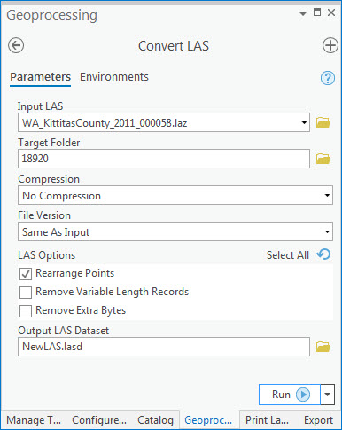
Unlike LAS (.las) files, LAZ (.laz) files cannot be opened or added directly to ArcGIS Pro to display point cloud data on a map. However, it is possible to convert the LAZ files to LAS datasets to display on the map. Use the Convert LAS tool to convert the LAZ file to a LAS dataset, and fill in the tool parameters as required. Refer to Convert LAS for more information on the tool.
Article ID: 000018920
- ArcGIS Pro 2 x
Get support with AI
Resolve your issue quickly with the Esri Support AI Chatbot.


Related Information
Discover more on this topic
Search for related information
Find training related to this topic
Explore ideas and give feedback
Get help from ArcGIS experts
Start chatting now