HOW TO
Open LAZ files in ArcMap
Summary
LAZ is a compressed light detection and ranging (lidar) data format that is often used to transfer large amounts of lidar data. ArcMap can process LAS files but not LAZ files. To open and use LAZ files in ArcMap, they must first be converted to LAS using the spatial ETL tool.
Procedure
The following steps describe how to create a spatial ETL tool to convert LAZ files to LAS. The steps to create a spatial ETL tool are also provided in the following document: Creating a spatial ETL tool.
Note:
A Data Interoperability license is required to create the spatial ETL tool.
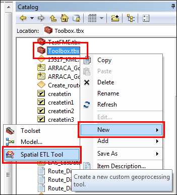
- Create a new toolbox to create the spatial ETL tool.
- In Catalog, navigate to a folder or geodatabase to create a new toolbox.
- Right-click the folder or geodatabase and click New > Toolbox. Rename the new toolbox as desired.
- Right-click the new toolbox and click New > Spatial ETL Tool.
The Generate ETL Tool dialog box opens.
- In the Generate ETL Tool dialog box, convert the LAZ file to LAS using the created spatial ETL tool.
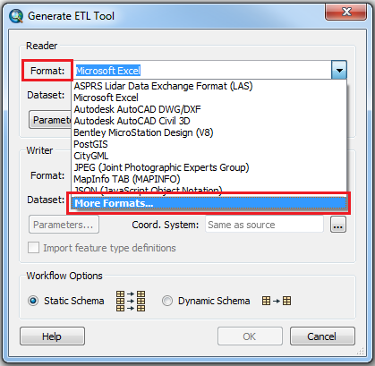
- In the Generate ETL Tool dialog box, under the Reader section, click the drop-down arrow for the Format, and click More Formats.
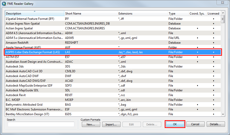
- In the FME Reader Gallery dialog box, select ASPRS Lidar Data Exchange Format (LAS), and click OK.
- In the Dataset field under the Reader section, click Open file browser
 to navigate to the LAZ file.
 - Under the Writer section, click the drop-down arrow for the Format, and click More Formats.
- In the FME Writer Gallery dialog box, select ASPRS Lidar Data Exchange Format (LAS), and click OK.
- In the Dataset field under the Writer section, specify a folder for the output LAS file.
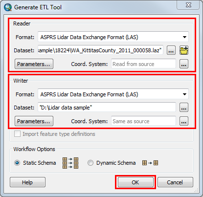
- Click OK. The Spatial ETL Tool dialog box is launched.
- Click the Run Translation
 button. The Translation Log window is opened. The translation log displays 'Translation was SUCCESSFUL' if the translation process succeeds. The LAS file is created with the extension .las and it is located in the folder specified in Step 2 (f).
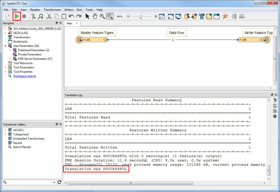
- Close the Spatial ETL Tool dialog box.
- In the Generate ETL Tool dialog box, under the Reader section, click the drop-down arrow for the Format, and click More Formats.
- Create a LAS dataset from the LAS file to view in ArcMap. For more information, refer to Creating a LAS dataset.
Note:
The capability to visualize lidar data (in LAS, LAZ, and zLAS file formats) is introduced in ArcGIS Pro 2.1. The Create Scene Layer Package tool can be used to create a point cloud scene layer from lidar data. To do this, refer to Create a point cloud scene layer. The created point cloud scene layer can be published as a service layer, and uploaded to ArcGIS Enterprise or ArcGIS Online using the Share Package tool.
Article ID: 000018224
- ArcMap
Get support with AI
Resolve your issue quickly with the Esri Support AI Chatbot.


Related Information
Discover more on this topic
Search for related information
Find training related to this topic
Explore ideas and give feedback
Get help from ArcGIS experts
Start chatting now