问题
问题:无法使用“圆”工具创建圆要素
描述
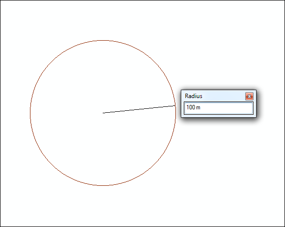
When creating a circle feature using the Circle tool by specifying the radius value and a unit abbreviation other than map units in the Radius window, the tool fails to create the feature. However, the documentation on creating a circle feature using the Circle tool states that it is possible to specify the radius value in units other than the map units by specifying the unit abbreviation with the radius value entered. For example, users must enter 100 m to create a circle with 100 meters radius. The image below is an example of creating a circle feature by entering the radius value with a unit abbreviation.
原因
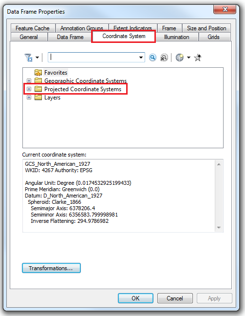
A possible cause for this issue is that the coordinate system used by the data frame is a geographic coordinate system. A geographic coordinate system, such as NAD 1927, uses decimal degrees as the measurement unit. It is not possible to create a circle feature using the Circle tool by specifying a radius value with a unit abbreviation other than the map units if the data frame uses a geographic coordinate system.
Refer to the following article for steps to check the coordinate system of the data frame, How To: Check the coordinate systems of the data frame and layers in ArcMap.
Note:
The behavior described above is expected. It is not recommended to edit precise distances for data covering smaller areas using a geographic coordinate system. It is best to use a projected coordinate system that is local to the specific study area of the data for better accuracy and functionality.
解决方案或解决方法
As a workaround, change the coordinate system used by the data frame to a projected coordinate system. Refer to the following document for steps to change the data frame's coordinate system: Changing the data frame's coordinate system, and select a projected coordinate system from the Projected Coordinate Systems folder.
文章 ID: 000015893
获得人工智能支持
使用 Esri Support AI Chatbot 快速解决您的问题。


相关信息
发现关于本主题的更多内容
Search for related information
Find training related to this topic
Explore ideas and give feedback
获取来自 ArcGIS 专家的帮助
立即开始聊天