操作方法
操作方法:将设计和工程文件上传到 Site Scan Manager for ArcGIS
摘要
Comparing high-quality, accurately georeferenced Site Scan orthomosaics with design and engineering files enable easy identification of as-built deviations and potential rework requests. Georeferenced design files can be uploaded directly to Site Scan Manager for ArcGIS for comparison, or for other teams to translate CAD files to a local coordinate system.
过程
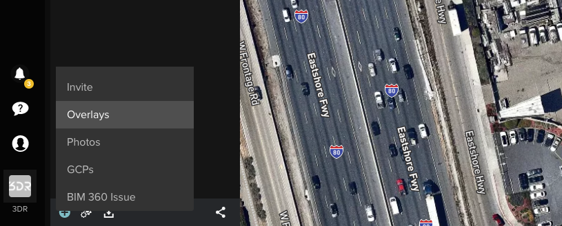
- Open the Add tab on the bottom-left corner of the screen. Georeferenced files in a zipped .shp, .kml, or .geojson format can be uploaded directly using the Overlays feature.
Note:
The zipped shapefile (.shp) should contain these files: .shp, .dbf, .idx, .prj and .shx.
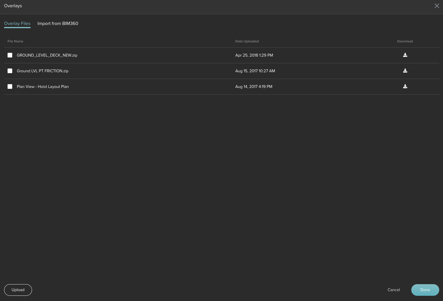
- Upload the .zip file using the Overlays interface below. The file takes approximately two minutes to process into tiles ready for viewing.
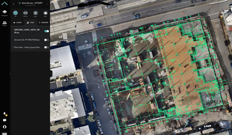
- View and analyze the overlain CAD file along with any of the flights within the project. It is possible to track progress more accurately, flag potential areas for rework, and minimize communication breakdown between subcontractors and stakeholders.
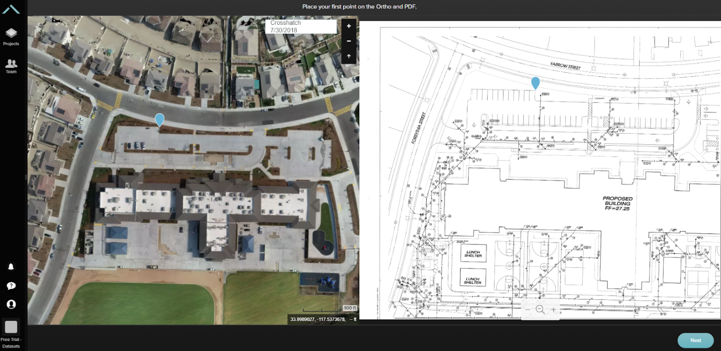
- If the file is not georeferenced, such as a .pdf, it is required to geotag it. Site Scan for ArcGIS provides an interface to drop two different pins on the orthomosaic and the design .pdf file. Click Next to drop two additional markers and Site Scan processes the file to make it available.
文章 ID: 000023052
获得人工智能支持
使用 Esri Support AI Chatbot 快速解决您的问题。


发现关于本主题的更多内容
Search for related information
Find training related to this topic
Explore ideas and give feedback
获取来自 ArcGIS 专家的帮助
立即开始聊天