操作方法
操作方法:向 ArcGIS Survey123 Connect 的底图库中添加 ArcGIS Pro 自定义底图
摘要
A custom basemap is added to geopoint, geotrace, and geoshape question types to display important features specific to a survey region. For example, a custom basemap can be used to display building footprints and labels in an area. In ArcGIS Survey123 Connect, linked custom basemaps are displayed in the Basemap gallery.
This article provides instructions to add a custom basemap linked to a survey to the Survey123 Connect Basemap gallery.
过程
- In ArcGIS Pro, create and publish the custom basemap to ArcGIS Online.
- Author a custom basemap in ArcGIS Pro.
- Publish the custom basemap as a web feature layer. Refer to ArcGIS Pro: Share a web feature layer using the default configuration for more information.
- In ArcGIS Online, add the custom basemap as a feature layer to a web map, and save the web map.
- In Map Viewer, open the published feature layer in Step 1b.
- Save the map as a web map.
- In Survey123 Connect, select the Standard option.
- Log in to Survey123 Connect with the same organization credentials as ArcGIS Online.
- Click the icon on the top-right corner of the app, and select Settings.
- Click Map, and select Standard.
Note:
The map type must be changed in the Survey123 field app. With the 3.10 release of ArcGIS Survey123 Standard map type is automatically enabled.
- Link the custom basemap to the survey. Refer to ArcGIS Survey123: Use an online map in your survey for more information.
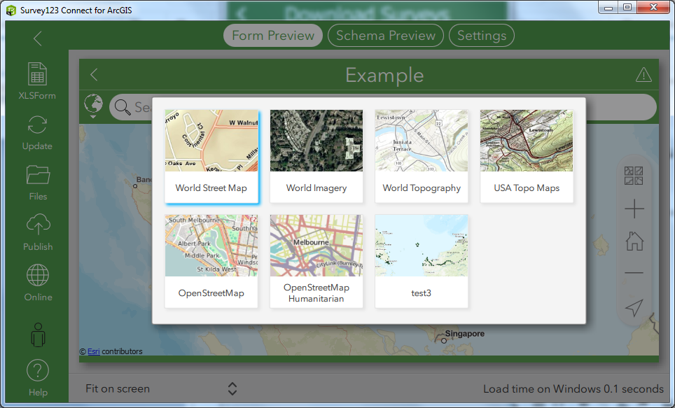
In Form Preview, the custom basemap, referred to as test3 in the sample image below, is listed in the Basemap gallery. This is reflected in the Survery123 field app and the Survey123 web app.
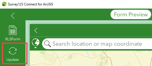
Note:
To see the changes in the Basemap gallery, it may be necessary to refresh the survey by clicking Update.
文章 ID: 000023408
获得人工智能支持
使用 Esri Support AI Chatbot 快速解决您的问题。


相关信息
发现关于本主题的更多内容
Search for related information
Find training related to this topic
Explore ideas and give feedback
获取来自 ArcGIS 专家的帮助
立即开始聊天