HOW TO
Convert a floating type raster to a polygon feature class and retain its decimal values in ArcGIS Pro
Summary
In ArcGIS Pro, a raster dataset can be vectorized when using the Raster to Polygon tool to generate a polygon feature output. However, the Raster to Polygon tool can only process integer input rasters. Therefore, a floating type raster must be converted to an integer type raster before using the tool.
The workflow provided describes how to convert a floating type raster to a polygon feature class and retain its decimal values in ArcGIS Pro. This is accomplished by first removing the decimal values from the floating type raster and then converting it to an integer type raster. Following this, the integer type raster is converted to a polygon feature class, and the decimal values are restored.
Procedure
Note:
The following workflow requires a Spatial Analyst license. The Int tool mentioned in this article is available in the Image Analyst, Spatial Analyst, and 3D Analyst toolsets.
- Start ArcGIS Pro and open the project.
- On the ArcGIS Pro ribbon, click Analysis > Tools to open the Geoprocessing pane.
Remove the decimal values of the floating type raster
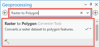
- In the Geoprocessing tool search pane, search for Raster Calculator in the search bar, and click Raster Calculator (Spatial Analyst Tools).
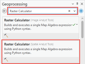
Note:
Refer to ArcGIS Pro: Raster Calculator (Spatial Analyst) for more information on the parameters in the Raster Calculator tool.
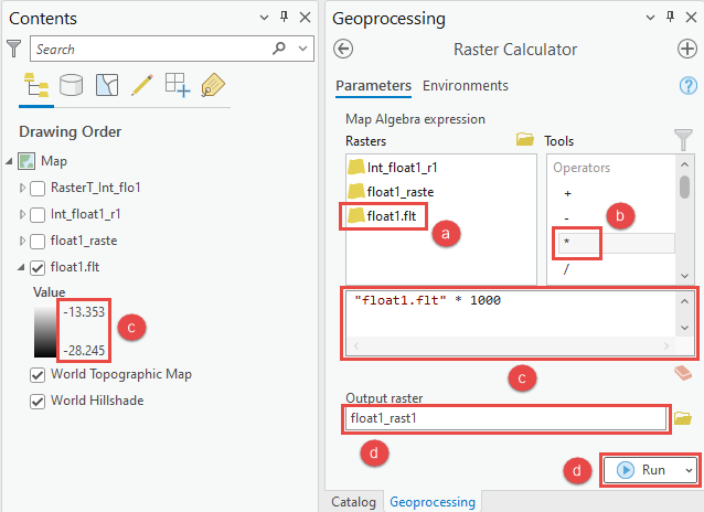
- In the Raster Calculator pane, multiply the raster by 10 to remove the decimal values.
- Double-click the raster in the Rasters section.
- Double-click the multiplication operator (*) in the Tools section.
- Input the required multiple of 10 in the Expression parameter. In this example, 1000 is used because the raster contains floating values with three decimal places.
- Specify a name for Output raster and click Run.
Convert the floating type raster to an integer type raster
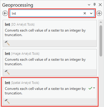
- In the Geoprocessing tool search pane, search for Int in the search bar, and click Int (Spatial Analyst Tools).
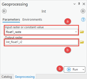
- In the Int pane, configure the following parameters:
- For Input raster or constant value, select the raster created from the Raster Calculator tool.
- Specify a name for Output raster and click Run.
Convert the integer type raster to a polygon feature class
- In the Geoprocessing tool search pane, search for Raster to Polygon in the search bar, and click Raster to Polygon (Conversion Tools).
Note:
Refer to ArcGIS Pro: Raster to Polygon (Conversion) for more information on the parameters in the Raster to Polygon tool.
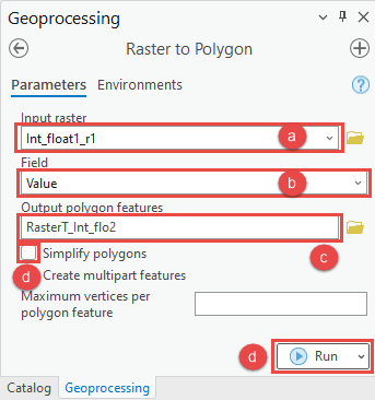
- In the Raster to Polygon pane, configure the following parameters:
- For Input raster, select the raster created from the Int tool.
- For Field, select Value.
- Specify a name for Output polygon features.
- Uncheck the Simplify polygons check box and click Run.
Restore the decimal values of the polygon feature class
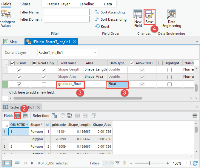
- In the Contents pane, right-click the newly created polygon feature class and click Attribute Table.
- Click Add in the attribute table to add a new field in the table.
- In the fields view, specify a name for the Field Name field, and select Float for the Data Type field.
- Save the modifications to the table.
- In the attribute table, right-click the newly created field and click Calculate Field.
Note:
Refer to ArcGIS Pro: Calculate Field (Data Management) for more information on the parameters in the Calculate Field tool.
- In the Calculate Field window, configure the following parameters:
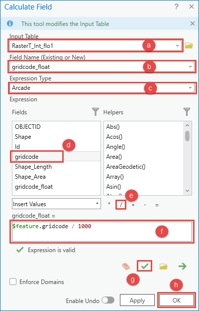
- For Input Table, select the polygon feature class.
- For Field Name, select the newly created field.
- For Expression Type, select Arcade.
- Double-click the gridcode field in the Fields section.
- Click the division operator (/) in the Helpers section.
- Input the required multiple of 10 in the Expression parameter. In this example, 1000 is used because the raster contains floating values with three decimal places.
- Click Verify to test the Arcade expression.
- Click OK.
Article ID: 000028071
- ArcGIS Pro 3 0
- ArcGIS Pro 2 8 x
- ArcGIS Pro 2 x
Get support with AI
Resolve your issue quickly with the Esri Support AI Chatbot.


Related Information
Discover more on this topic
Search for related information
Find training related to this topic
Explore ideas and give feedback
Get help from ArcGIS experts
Start chatting now