Frequently asked question
Can the date of an image be determined from the World Imagery basemap?
Yes, it is possible to determine the date of an image (specifically, any region of the satellite imagery) in the Imagery basemap. The World Imagery basemap is a compilation of imagery sources for the world and it comprises datasets that cover both large and small areas.
Note:
The basemap is made up of several imagery tiles. Different tiles and different zoom levels are taken on different dates. Updates occur on the different images within the basemap, and there is no actual known cycle for this activity. Refer to FAQ: How frequently is the World Imagery basemap updated? for more information.
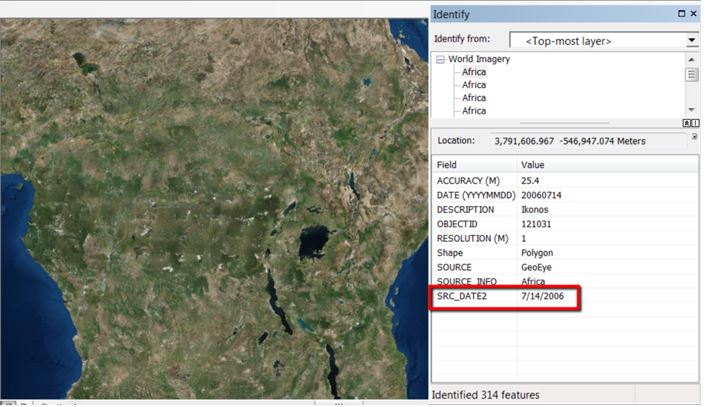
In ArcMap, the Identify tool can be used to determine the date the satellite image was taken in the World Imagery basemap.

To view the date, click the desired area using the Identify tool. The date is displayed in the Identify window, as seen in the image below. In this example, the date displayed represents the source date of the TeraColor NextGen image.
To use this tool, refer to ArcMap: Identifying features.
Note:
To view the date of an image from the World Imagery basemap as well as its metadata in ArcGIS Pro, refer to How To: View the World Imagery basemap metadata in ArcGIS Pro.
Article ID: 000012181
- ArcMap
Get support with AI
Resolve your issue quickly with the Esri Support AI Chatbot.


Related Information
Discover more on this topic
Search for related information
Find training related to this topic
Explore ideas and give feedback
Get help from ArcGIS experts
Start chatting now