PROBLEM
Unable to import custom .prj files with additional comments
Description
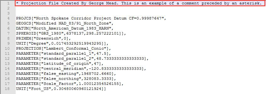
Projection files (.prj) are used to store the projected coordinate system defining the parameters and the linear units used in the projection with the description of the geographic coordinate system. In ArcGIS Desktop 10.3 and previous, it is possible to create a custom .prj file with additional comments and special characters such as asterisk (*), as shown below.
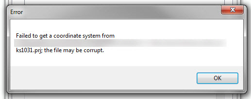
Failed to get a coordinate system from <filename>.prj; the file may be corrupt.
Cause
Starting with ArcGIS for Desktop 10.4, .prj files must include only projection parameters and information related to coordinate systems. Additional comments and the use of special characters in .prj files is no longer supported. Prj files containing text unrelated to the projection parameters render the .prj files corrupt.
Solution or Workaround
Remove the additional comments and characters from the custom .prj files. Ensure only projection parameters are stored in the custom .prj files.Article ID: 000017133
- ArcMap
Get support with AI
Resolve your issue quickly with the Esri Support AI Chatbot.


Related Information
Discover more on this topic
Search for related information
Find training related to this topic
Explore ideas and give feedback
Get help from ArcGIS experts
Start chatting now