PROBLEM
Polygons captured in an ArcGIS Survey123 survey form do not display in ArcGIS Online Map Viewer
Description
Geoshape questions in ArcGIS Survey123 allow the creation of polygons on a map using geometry in a feature layer instead of points. When viewing the feature layer in ArcGIS Online, the polygons captured in the ArcGIS Survey123 form do not display in Map Viewer.
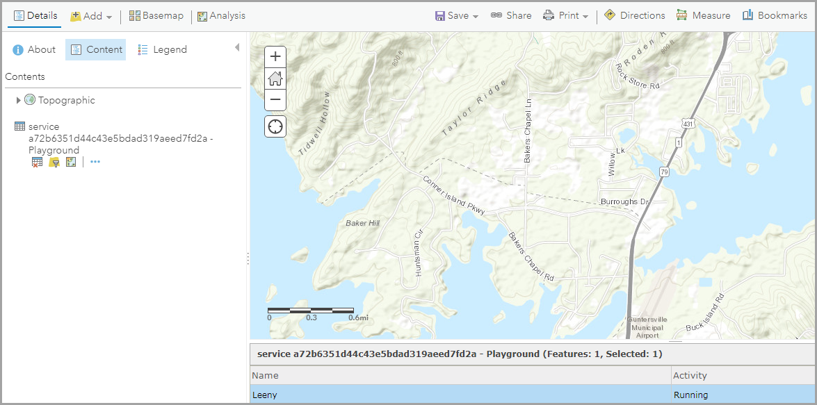
The image below shows a survey feature layer in Map Viewer, but the captured polygon is not displayed.
Cause
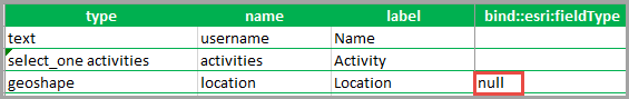
In the XLSForm of the survey, the bind::esri:fieldType column of the geoshape field is set to 'null', which prevents the polygons from being created.
Solution or Workaround
Note: In ArcGIS Online, click the More Options buttonnext to the survey form, and select the Edit in Survey123 Connect option. In ArcGIS Survey123 Connect, download the survey form to access the XLSForm.
- In the XLSForm, delete null from the bind::esri:fieldType column of the geoshape field.
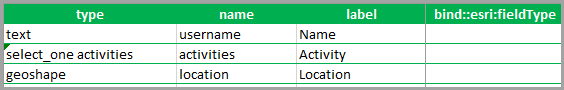
- Save the change in the XLSForm, and republish the survey.
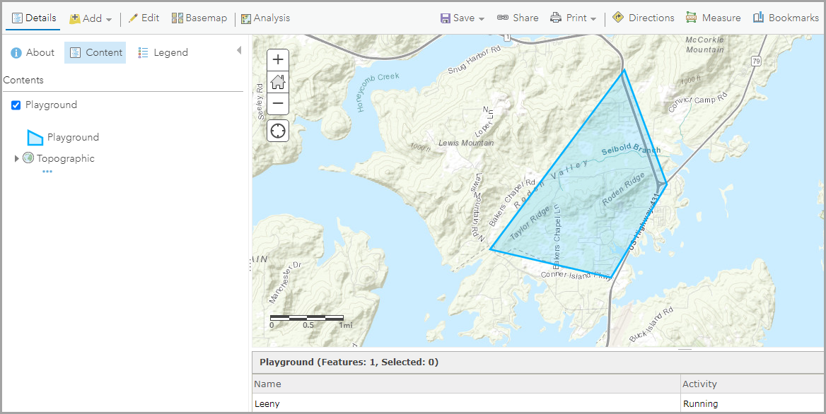
The image below shows the polygon captured in the survey form is displayed in Map Viewer.
Article ID: 000024525
- ArcGIS Online
- ArcGIS Survey123 Connect
- ArcGIS Survey123 Website
Get support with AI
Resolve your issue quickly with the Esri Support AI Chatbot.


Related Information
Discover more on this topic
Search for related information
Find training related to this topic
Explore ideas and give feedback
Get help from ArcGIS experts
Start chatting now