PROBLEM
Exporting contour lines to CAD format outputs incorrect elevation values
Description
In ArcMap, when exporting a contour feature class containing elevation values to CAD format using the Export To CAD tool, the output CAD file does not preserve the elevation values of the contour lines; the contour lines in the CAD file displays incorrect elevation values.
Cause
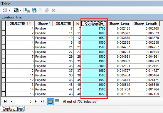
When exporting a contour feature class to CAD format, the Export To CAD tool searches for a field with the name Elevation or Contour containing the elevation values . When the tool fails to find the specific field, the output CAD file does not preserve the elevation values of the contour lines. The image below is an example of the attribute table of a contour feature class containing elevation values recorded in a field named other than Elevation or Contour.
Solution or Workaround
Use one of the following options to resolve the issue:
Create a copy of the feature class to rename the field containing the elevation valueThis option creates a copy of the contour lines feature class and renames the field containing the elevation values to Elevation or Contour in the copied feature class attribute table. This method preserves the name of the original feature class attribute table. Any changes made to the field name are only reflected in the copied feature class.
- In ArcToolbox, navigate to Conversion Tools > To Geodatabase > Feature Class to Feature Class.
- Select the contour feature class for the Input Features.
- In the Output Location parameter, select a geodatabase to locate the output feature class.
- Set a name for the Output Feature Class.
- In the Field Map parameter, rename the field name containing the elevation values to Elevation or Contour.

- Click OK.
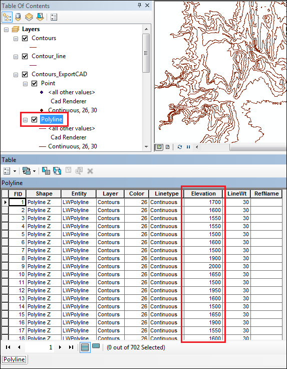
To export the contour lines to CAD, use the newly created feature class as the input for the Export To CAD tool. The exported CAD file shows the correct elevation values in the Elevation field of the Polyline attribute table.
Create a new field in the contour feature class with the name either Elevation or Contour
Another alternative is to create a new field in the contour feature class containing the correct elevation values, and name the new field as Elevation or Contour. Use the Field Calculator tool to populate the new field with the elevation values. The following technical article provides a step-by-step workflow of this method, How To: Retain elevation values when converting from a shapefile to CAD.
Article ID: 000017717
- ArcMap
Get support with AI
Resolve your issue quickly with the Esri Support AI Chatbot.


Related Information
Discover more on this topic
Search for related information
Find training related to this topic
Explore ideas and give feedback
Get help from ArcGIS experts
Start chatting now