ERROR
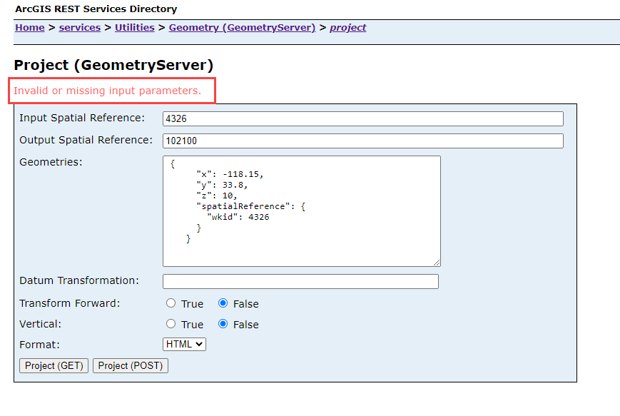
"Invalid or missing input parameters" error after performing Project operation from REST on a Geometry Service
Error Message
When performing a Project operation on a Geometry Service from REST:
ArcGIS REST Services Directory Home > services > Utilities > Geometry (GeometryServer) > project,
the following error may be encountered:
"Invalid or missing parameters."
Some examples are shown in the following images:

Cause
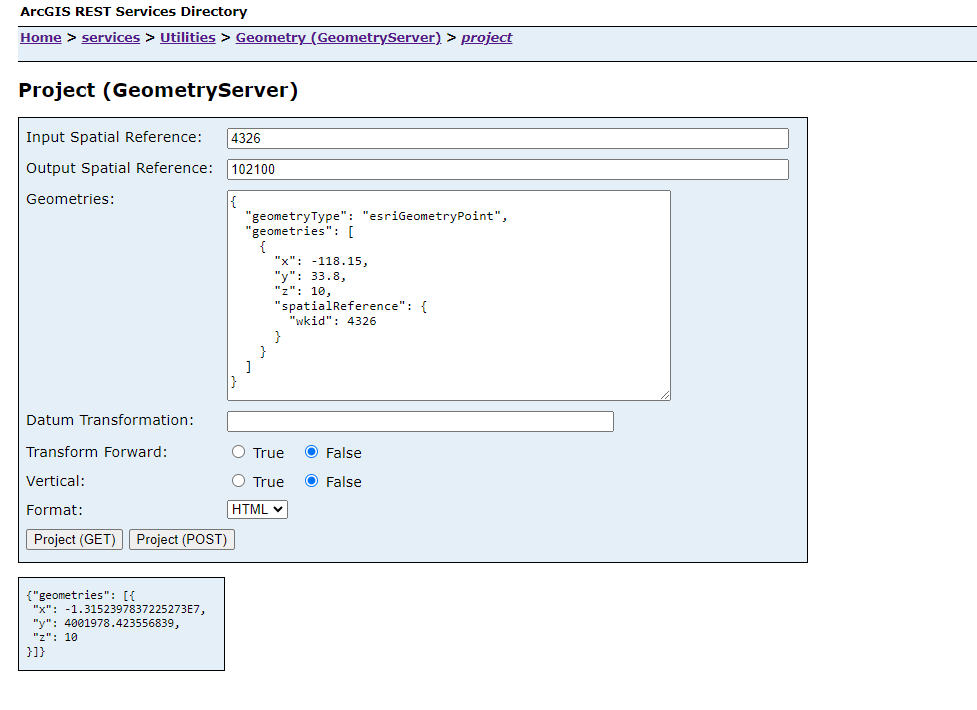
One cause of this may be the formatting of the Geometries parameter. This parameter should be completed with an array of the geometries to be projected. The structure of each geometry in the array is the same as the structure of the JSON geometry objects returned by the ArcGIS REST API. For reference, see, the ArcGIS REST APIs documentation: JSON geometry objects.
Solution or Workaround
Use the JSON Geometry objects and Geometries parameter documentation to make sure that the array is formatted correctly, based on the type of geometry.
The following example shows the formatting for the 3D esriGeometryPoint type:
{
  "x": -118.15,
  "y": 33.80,
  "z": 10.0,
  "spatialReference": {
    "wkid": 4326
  }
}
Article ID: 000031959
- ArcGIS REST API
Get support with AI
Resolve your issue quickly with the Esri Support AI Chatbot.


Related Information
Discover more on this topic
Search for related information
Find training related to this topic
Explore ideas and give feedback
Get help from ArcGIS experts
Start chatting now