HOW TO
Find the centroid between multiple polygon features in ArcGIS Online
Summary
The ability to locate the center location between many areas is crucial, for instance, to study the migration distance, determine appropriate locations to build dams, and to infer optimum locations for construction of gas stations or shopping malls.
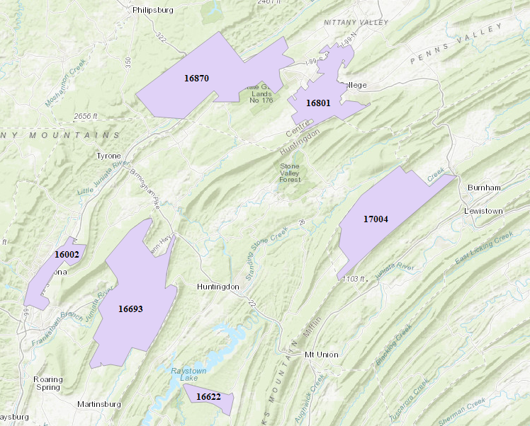
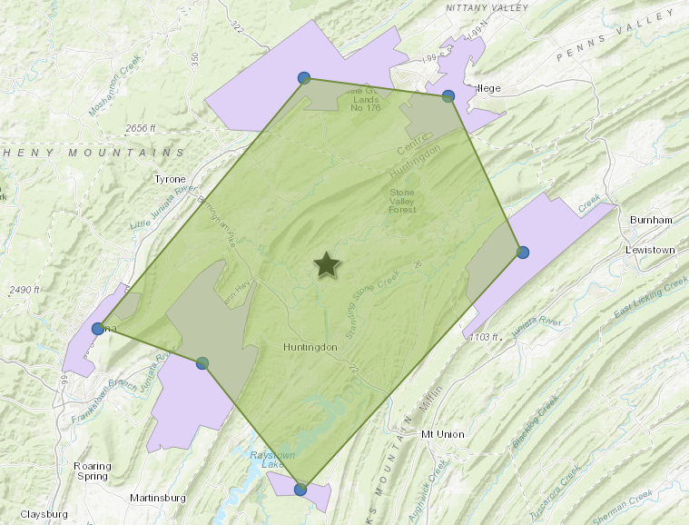
The image below shows six regions in Central Pennsylvania represented by their respective zip codes. A centroid between all these zip codes is to be determined.
Procedure
The following steps describe how to find the centroid between multiple polygon features in ArcGIS Online:
- Find the centroid for each polygon by navigating to Analysis > Find Locations > Find Centroids.
- In the Find Centroids pane, configure the following settings..
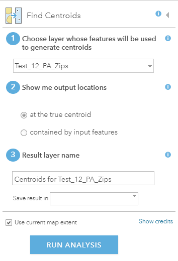
- Specify the polygon layer.
- Determine the output locations by selecting the at the true centroid option.
- Specify the result layer name and the location to save the layer in.
- Click RUN ANALYSIS.
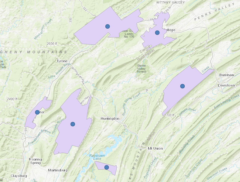
The image below shows centroids created at the center of each polygon.
- Create a polygon to combine all the centroids between different polygons by clicking the Add drop-down button > Add Map Notes. Specify the Name field, and click CREATE.
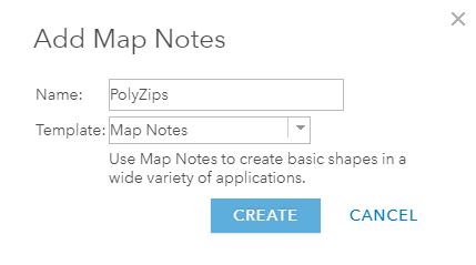
- In the Add Features dialog box, select the Area polygon.
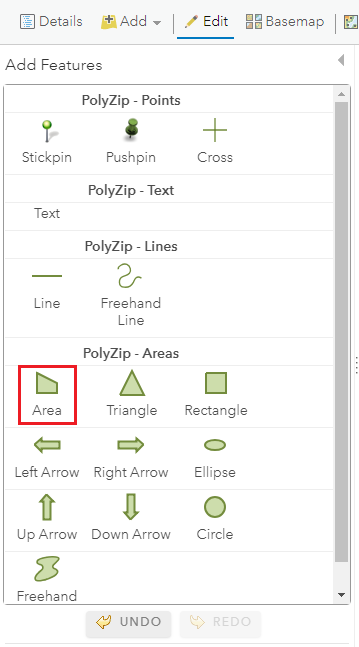
- Create a polygon by combining all the centroids created in Step 1.

- Find the centroid of the polygon created in Step 4 by navigating to Analysis > Find Locations > Find Centroids. In the Find Centroids pane, specify the layer as the polygon layer created in Step 4.
The image below shows the centroid between the six zip codes polygons. The center location between all the zip codes is located in the town of Ribot, Pennsylvania.
Article ID: 000018271
- ArcGIS Online
Get support with AI
Resolve your issue quickly with the Esri Support AI Chatbot.


Related Information
Discover more on this topic
Search for related information
Find training related to this topic
Explore ideas and give feedback
Get help from ArcGIS experts
Start chatting now