HOW TO
Display grid labels on multiple rows in an ArcGIS Pro layout
Summary
Grid labels in an ArcGIS Pro layout are formatted using tags. Tags can be used individually, or combined to create complex labels. This article highlights the workflow to display grid labels on multiple rows for graticule and measured grids in an ArcGIS Pro layout.
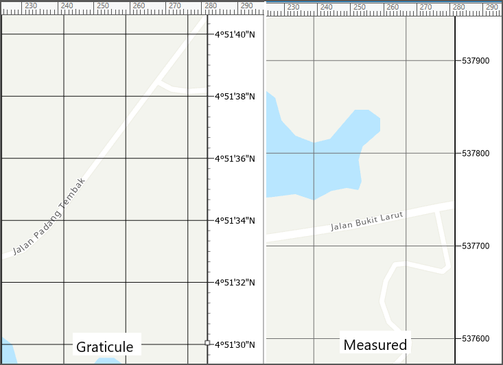
The following image shows how the labels are usually displayed.
Procedure
Splitting the graticule grid label
- In ArcGIS Pro, create a layout for the project. Refer to ArcGIS Pro: Add a layout to your project for more information.
- In the Contents pane, expand Map Frame. The Grids layer is created.
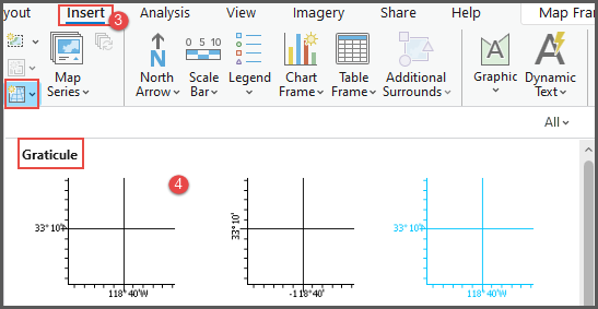
- On the ribbon, click the Insert tab.
- Click New Grid, under Graticule, select Black Horizontal Label Graticule.
- In the Black Horizontal Label Graticule pane, under Map Grid, click Components
 .
. - Under Appearance, in the Format text box, insert the following script.
<UND><dyn type="grid" units="dms.deg" decimalPlaces="0" showDirections="False" /><dyn type="grid" units="dms.deg.sym" decimalPlaces="0" showDirections="False" /></UND>

<UND><dyn type="grid" units="dms.min" decimalPlaces="0" showDirections="True" showZeroMinutes="False" showZeroSeconds="False"/><dyn type="grid" units="dms.min.sym" decimalPlaces="3" showDirections="True" showZeroMinutes="False" showZeroSeconds="False"/></UND>

<dyn type="grid" units="dms.sec" decimalPlaces="0" showDirections="True" showZeroMinutes="False" showZeroSeconds="False"/><dyn type="grid" units="dms.sec.sym" decimalPlaces="3" showDirections="True" showZeroMinutes="False" showZeroSeconds="False"/>
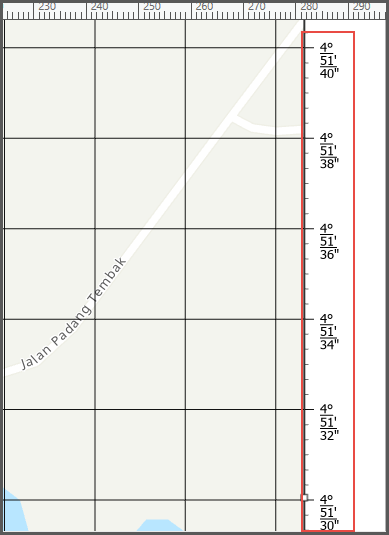
The image below shows the grid labels are displayed on two separate rows.
Splitting the measured grid label
- In the Contents pane, expand Map Frame. The Grids layer is created.
- On the ribbon, click the Insert tab.
- Click New Grid, under Measured Grid, select Black Horizontal Label Grid.
- In the Black Horizontal Label Grid pane, under Map Grid, click Components .
- Under Appearance, in the Format text box, insert the following script. Edit the placeValue from "1", "10", "1000", "10000", to "100000" to modify the digits to split into two lines.
<UND><dyn type="grid" placeValue="10000" digits="4" showDirections = "false"/></UND>

<dyn type="grid" placeValue="10000.right"/>
The image below shows the grid labels are displayed on two separate rows.
Article ID: 000031170
- ArcGIS Pro 3 1
- ArcGIS Dashboards
- ArcGIS Pro 3 0
- ArcGIS Pro 2 9x
Get support with AI
Resolve your issue quickly with the Esri Support AI Chatbot.


Related Information
Discover more on this topic
Search for related information
Find training related to this topic
Explore ideas and give feedback
Get help from ArcGIS experts
Start chatting now