HOW TO
Create discrete polygon features from an XY data table containing multipoint features
Summary
In some instances, polygon features created from an XY data table containing multipoint features with latitude and longitude may result in overlapping polygon features. The overlapping polygon features may be incomplete, and additional polygon features created. A polygon feature intersects another polygon feature, and splits the polygons into a few segments resulting in additional polygon features, as shown in the image below.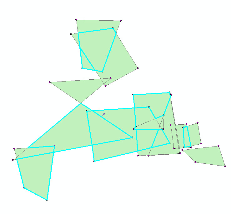
Procedure
Below are the steps to create discrete polygon features from an XY data table containing multipoint features in ArcMap.
- Use the Excel To Table tool to convert the XY data in the Excel file to a table, and add the XY data as a layer in ArcMap. For more detailed steps, refer to Step 1 in How To: Create a polygon from an XY data table.
- Run the Minimum Bounding Geometry tool on the converted XY data layer to create discrete polygon features with a specified minimum bounding geometry based on the input features.
- Click the Geoprocessing tab and select ArcToolbox.
- In ArcToolbox, navigate to Data Management Tools > Features > Minimum Bounding Geometry.
- In the Minimum Bounding Geometry dialog box, click the Input Features drop-down arrow, and select the XY data layer. Set a name and location for the Output Feature Class.
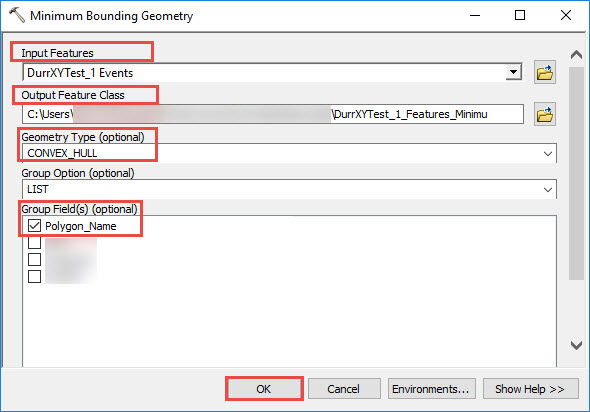
- Set the Geometry Type (optional) to CONVEX_HULL.
Note:
CONVEX_HULL geometry type forms a minimum boundary of a simple closed polygon based on the input features.
- Set the Group Option (optional) to LIST.
- In Group Field(s) Optional, check one or more fields if required to create the polygons, for example, Polygon Name. Click OK to view the polygons.
Note:
The LIST Group Option groups the input features based on the values stored in the specified field. To use the LIST option, one or more group fields must be selected. Group Field(s) groups the features based on the field or fields in the input features.
The image below shows the discrete polygon features from the XY data table containing multipoint features.

Article ID: 000018552
- ArcMap
Get support with AI
Resolve your issue quickly with the Esri Support AI Chatbot.


Related Information
Discover more on this topic
Search for related information
Find training related to this topic
Explore ideas and give feedback
Get help from ArcGIS experts
Start chatting now