
HOW TO
Create buffers with a specific unit of measurement
Summary
In ArcGIS Pro, when creating a buffer for a feature layer using the numerical values of a field, the buffer distance's unit is referred to the feature layer's spatial reference unit.
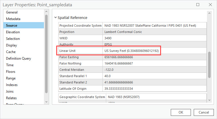
The image below shows the linear unit of the Point_sampledata layer as US Survey Feet.
Note:
Refer to ArcGIS Pro: Types of units for more information on the supported linear units in ArcGIS Pro.
This article provides the workflow to create buffers using values from an existing field in a desired unit rather than the unit of the feature layer's spatial reference. In this example, meters is added to the field values in the 'Point_sampledata' layer using the Calculate Field tool.
Procedure
- In ArcGIS Pro, right-click the desired layer in the Contents pane, select Attribute Table.
- In the attribute table, click Add
 .
. - Configure the fields table.
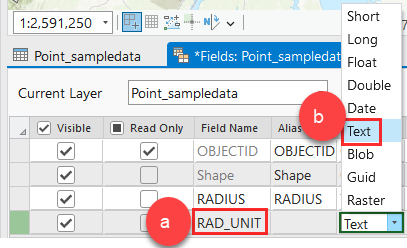
- Rename the new field to the required field name. In this example, the text field is ‘RAD_UNITS’.
- In the Data Type, double-click and select the Text data type. Refer to ArcGIS Pro: ArcGIS field data types for more information on field data types.
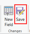
- On the Fields tab, in the Changes group, click Save.
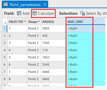
- Select the column of the newly added field, and click Calculate.
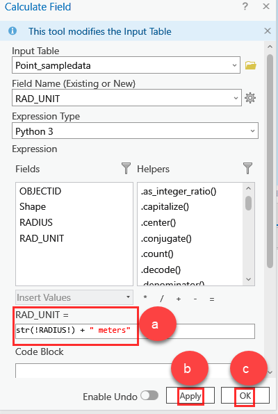
- In the Calculate Field window, insert the following Python expression in the expression text box.
str(<field_name>) + " <my_unit>"
- Replace <field_name> with the name of the field containing the buffer distance, and <my_unit> with the desired measurement unit. In this example, meters is specified as the measurement unit.
- Click Apply.
- Click OK.
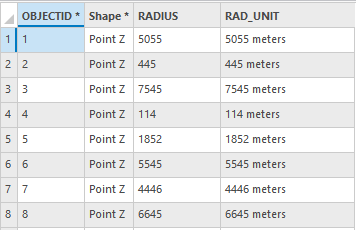
- On the Analysis ribbon, click Tools. In the Geoprocessing pane, search and select the Buffer (Analysis Tool).
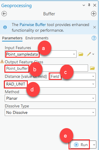
- Specify the Buffer parameters.
- For the Input Features parameter, select the feature layer. In this example, ‘Point_sampledata’ is selected.
- Rename the Output Feature Class. In this example, ‘Point_buffer’ is used.
- For Distance [value or field] parameters, select Field.
- Below the Distance [value or field], select the new field containing the values with the desired unit. In this example, ‘RAD_UNIT’ is selected.
- Click Run.
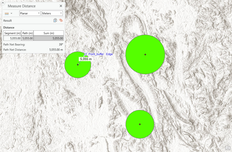
The image below shows the buffers created for the point features using the field values with the specified unit of measurement.
Article ID: 000030905
- ArcGIS Pro 3 1
- ArcGIS Pro 3 0
- ArcGIS Pro 2 9x
Get support with AI
Resolve your issue quickly with the Esri Support AI Chatbot.


Related Information
Discover more on this topic

Search for related information

Find training related to this topic

Explore ideas and give feedback
Get help from ArcGIS experts
Start chatting now