HOW TO
Add GNSS metadata fields to a hosted feature layer in ArcGIS Online
Summary
A Global Navigation Satellite System (GNSS) provides highly accurate geolocation data with global coverage to GNSS devices and receivers, which allows accurate location and elevation determination. In ArcGIS Online, adding GNSS metadata fields to a hosted feature layer allows field workers to capture essential GNSS information during data collection using ArcGIS Field Maps. These metadata fields contain information such as receiver type, satellite count, signal quality, and collection time. By capturing this metadata, the accuracy and readability of the location information can be evaluated, ensuring high-quality data for analysis and decision-making. This article provides the workflow to add GNSS metadata fields to a hosted feature layer in ArcGIS Online.
Procedure
- Log in to ArcGIS Online and export data from the preferred hosted feature layer to a file geodatabase. Refer to ArcGIS Online: Export data from hosted feature layers for instructions.
- On the file geodatabase’s item page, on the Overview tab, click Download. The file geodatabase is downloaded as a zip folder.
- Create a new hosted feature layer with the same layers and fields as the existing hosted feature layer.
- On the file geodatabase’s item page, click Content.
- On the My content tab, click New item, and click Feature layer.
- In the Create a feature layer window, click Select an existing feature layer and click Next.
- Select the same hosted feature layer from Step 1 and click Next.
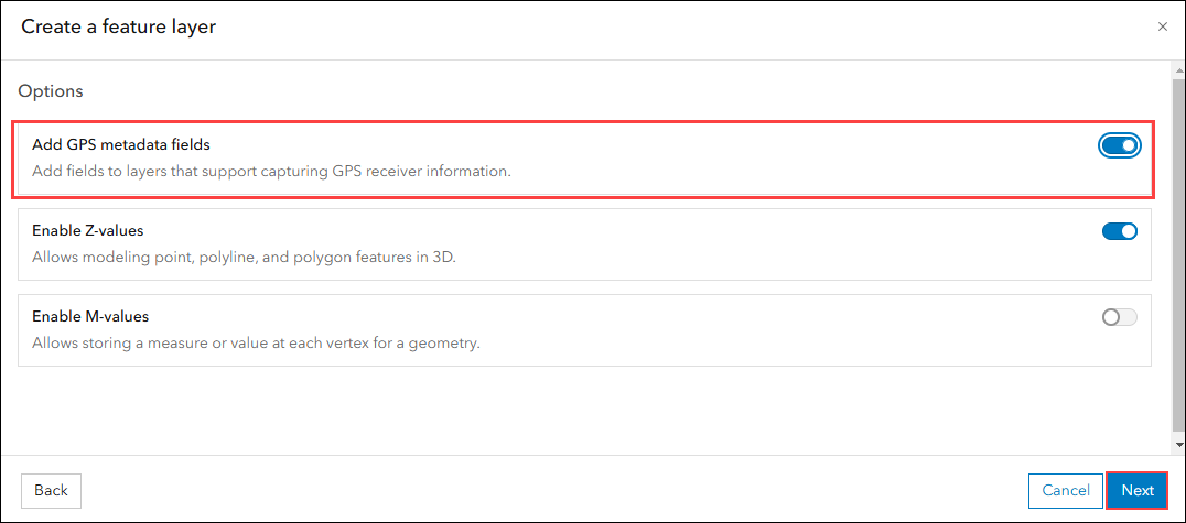
- Click Next and enable the Add GPS metadata fields option. Click Next.
- In the New item window, specify the Title and click Save.
- Update the layer from the newly created hosted feature layer with the feature layer from the downloaded file geodatabase in Step 2.
- On the newly created hosted feature layer's item page, on the Overview tab, click Update Data.
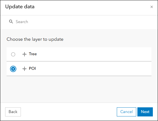
- In the Update data window, select Add and update features and click Next.
- Select the preferred layer from the hosted feature layer to be updated. In this example, the layer named POI is selected. Click Next.
- Click Your device and navigate to the downloaded file geodatabase in Step 2. Click Next.
- Select the same feature layer from the file geodatabase to update the selected layer in Step 4c. Click Next.
- Select the unique field from the hosted feature layer that matches the field in the uploaded file geodatabase from the drop-down list. Click Next.
- Click Next and select the Geometries and attributes option. Click Update and complete.
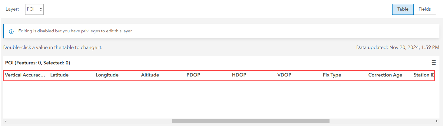
The image below shows the hosted feature layer with the added GNSS metadata fields in ArcGIS Online.
Article ID: 000034138
- ArcGIS Online
- ArcGIS Field Maps Android
- ArcGIS Field Maps iOS
Get support with AI
Resolve your issue quickly with the Esri Support AI Chatbot.


Related Information
Discover more on this topic
Search for related information
Find training related to this topic
Explore ideas and give feedback
Get help from ArcGIS experts
Start chatting now