Frequently asked question
What is a Grid Convergence Angle?
A Projected Coordinate System in most cases has a Central Meridian. The Central Meridian points directly to the North (or South) Pole.
A Grid Convergence Angle is formed if a point lies near, but not on, that Central Meridian, by drawing a line from that point to the Pole.
The angle between the Central Meridian and the line from the point to the Pole is the Convergence Angle. This is shown in the image below.
The Calculate Convergence Angle tool calculates the angle between the Central Meridian of the projected coordinate system applied to the data, and the line which intersects the point and runs from the point to the North (or South) Pole. A Convergence Angle between the Central Meridian of UTM Zone 15 North and the USGS Survey Control Point Meade's Ranch is shown in the following illustration.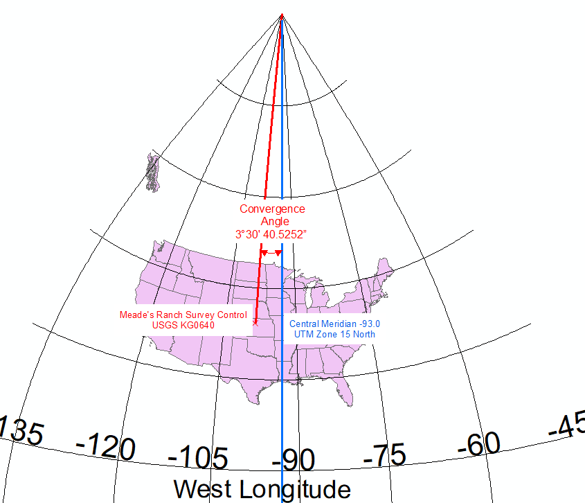
Note:
Convergence angles cannot exist in a Geographic Coordinate System, or in some projected coordinate systems like Web Mercator, because in these coordinate systems ALL lines of Longitude point directly at the North Pole.
Article ID: 000020700
Get support with AI
Resolve your issue quickly with the Esri Support AI Chatbot.


Related Information
Discover more on this topic
Search for related information
Find training related to this topic
Explore ideas and give feedback
Get help from ArcGIS experts
Start chatting now