A to Z GIS | Explore this related guide, featuring updated terms and graphics and developed in coordination with Esri’s GIS Dictionary team.
Learn more about A to Z GIS
GIS Dictionary
Browse dictionary
distortion
URL copiedShare URL
[standards]
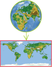
On a map or image, the misrepresentation of shape, area, distance, or direction of or between geographic features when compared to their true measurements on the curved surface of the earth.