A to Z GIS | Explore this related guide, featuring updated terms and graphics and developed in coordination with Esri’s GIS Dictionary team.
Learn more about A to Z GIS
GIS Dictionary
Browse dictionary
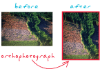
orthophoto
URL copiedShare URL
[photogrammetry]
A digitized aerial photograph that has been geometrically corrected to remove distortions— such as from camera orientation or elevation differences. An orthophoto has the same scale throughout and can be used as a map.