Häufig gestellte Frage (FAQ)
Ist es in ArcGIS Online Map Viewer möglich, gefilterte Daten in Shapefiles zu exportieren?
Yes, it is possible. After applying filters on a feature layer in ArcGIS Online Map Viewer, use the Extract Data tool from the Analysis tools in ArcGIS Online to export the layer to a shapefile. Complete the following workflow to achieve this.
Note:
The Extract Data tool is currently only supported in Map Viewer Classic (formerly Map Viewer). It will be available in a future release of the new Map Viewer (formerly Map Viewer Beta).
Warning:
Running the Extract Data tool consumes credits, depending on the number of records and the generated output. Click Show credits before running the tool to check the credit costs. Refer to ArcGIS Online: Understand credits for more information.
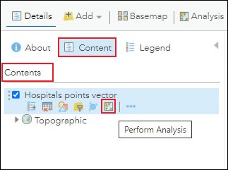
- In ArcGIS Online Map Viewer Classic, on the Contents pane, hover over the desired layer, and click the Perform Analysis
 icon.
icon.
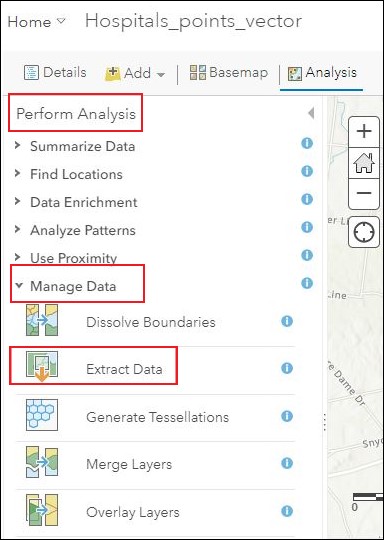
- On the Perform Analysis pane, click Manage Data > Extract Data.
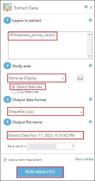
- On the Extract Data pane, specify the parameters below, accordingly, to run the tool.
- For Layers to extract, check the layer's check box.
- For Study area, under Same as Display, select Select features.
- For Output data format, select Shapefile (.zip).
- For Output file name, specify a name.
- Click RUN ANALYSIS.
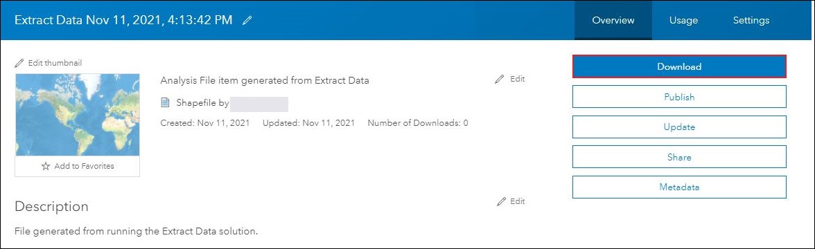
- In ArcGIS Online, download the shapefile from My Content.
- In ArcGIS Online, click Content > My Content.
- On the My Content page, click the extracted shapefile.
- On the shapefile's item details page, click Download. The shapefile is downloaded as a .zip file.
Artikel-ID: 000026789
Holen Sie sich Unterstützung mit KI
Lösen Sie Ihr Problem schnell mit dem Esri Support AI Chatbot.


Zugehörige Informationen
Weitere Informationen zu diesem Thema erkunden
Search for related information
Find training related to this topic
Explore ideas and give feedback
Unterstützung durch ArcGIS-Experten anfordern
Beginnen Sie jetzt mit dem Chatten