Frequently asked question
Is it possible to view a geopoint location from ArcGIS Survey123 Connect in Google Maps?
Yes, it is possible to view a geopoint location from ArcGIS Survey123 Connect in Google Maps, and several methods are described below.
Use an expression in the ArcGIS Survey123 Connect application
The expression containing the pulldata() function is added to the XLSForm. However, this process only works in the ArcGIS Survey123 application and not in the browser.
- In the XLSForm, use geopoint as a question type to capture the location of the survey.
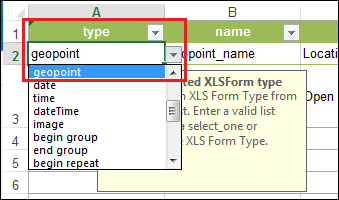
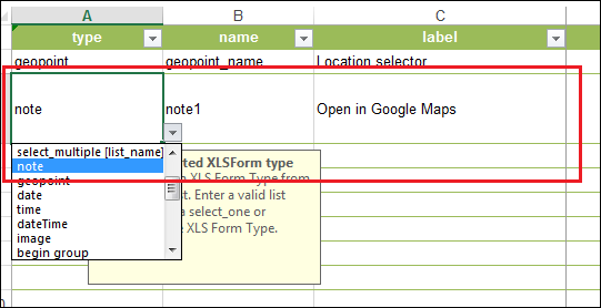
- Use note as a question type and fill in the name and label field.
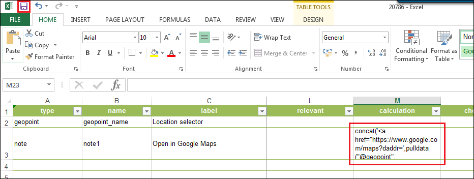
- In the calculation field, enter the following expression:
concat('<a href="https://www.google.com/maps?daddr=',pulldata ("@geopoint", ${geopoint_name}, "y"), ',' ,pulldata("@geopoint", ${geopoint_name}, "x"), concat('&ll=">Click to open</a>'))
- Click Save icon to save the XLSForm.
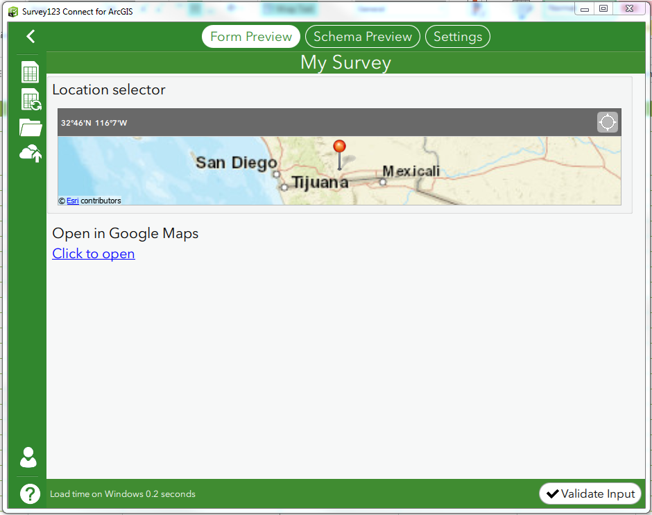
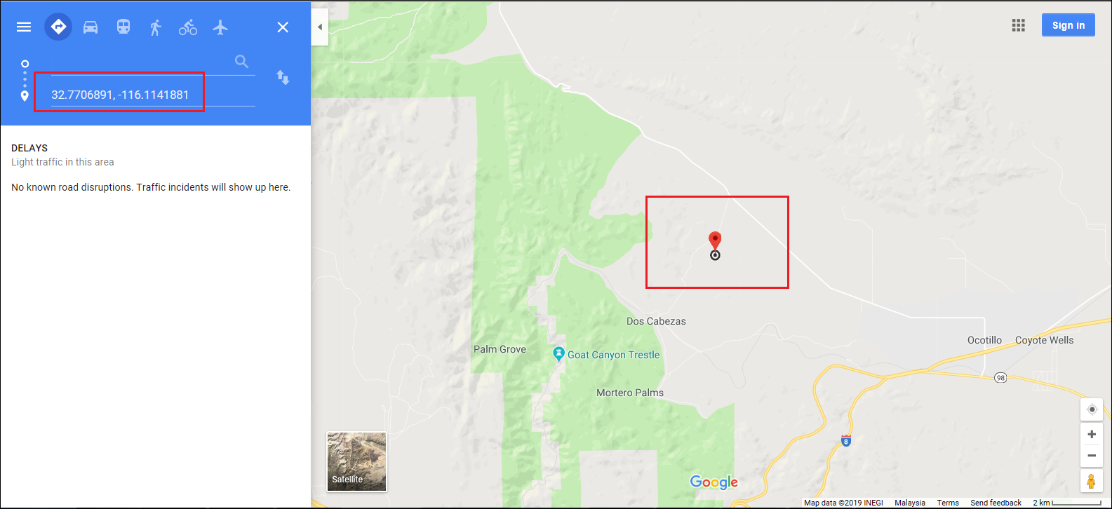
In Form Preview in the ArcGIS Survey123 Connect application, select the desired location in Location Selector and select Click to open to view the location in Google Maps.
Use an online map in the survey
The default basemap in the ArcGIS Survey123 Connect map setting can be changed from the ArcGIS Survey123 field app in the menu on the map page of the survey. To change the basemap, a URL must be added to the survey .info file. For more information, refer to ArcGIS Survey123: Use an online map in your survey.
Article ID: 000020786
- ArcGIS Survey123 Connect
Get support with AI
Resolve your issue quickly with the Esri Support AI Chatbot.


Related Information
Discover more on this topic
Search for related information
Find training related to this topic
Explore ideas and give feedback
Get help from ArcGIS experts
Start chatting now