HOW TO
Create contour lines from an ASCII file in ArcGIS Pro
Summary
An ASCII (.asc) formatted text file representing raster data consists of header information, such as the number of columns and rows, coordinates of the lower left corner of the lower left cell, cell size of the raster, etc., describing the values of each cell in the file.
It is not possible to open an ASCII file directly in ArcGIS Pro. The file must first be converted to a raster dataset, and the Contour tool must be used to create contour lines.
Procedure
The instructions provided describe how to create contour lines from the ASCII file in ArcGIS Pro.
- Use the ASCII to Raster tool to convert the ASCII file to raster.
- In ArcGIS Pro, open a new blank project.
- In the Analysis tab, click the Tools icon in the Geoprocessing group to activate the Geoprocessing pane.
- Navigate to Toolboxes > Conversion Tools > To Raster > ASCII to Raster.
- In the Parameters section, browse the ASCII file as the Input ASCII raster file.
- Set a name and location for the Output raster.
- Select Integer or Float as the Output data type.
Note:
Integer only stores integral values, that is, whole numbers. Float stores floating-point values, that is, values that have potential decimal places.
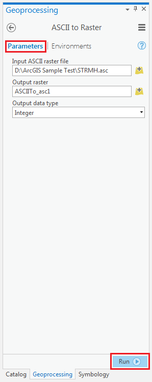
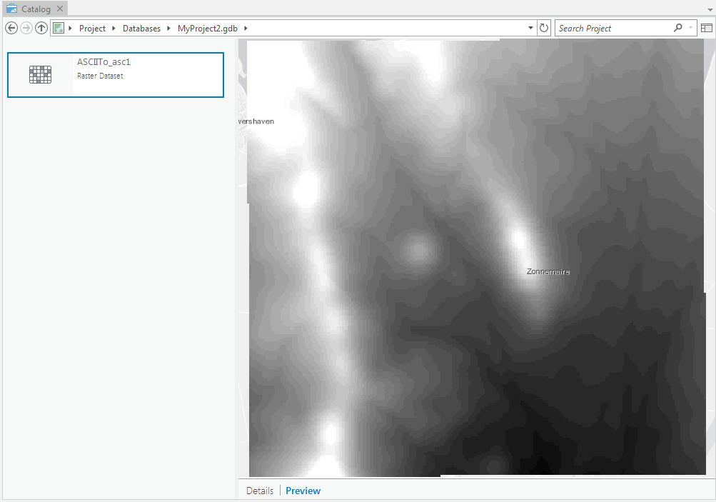
- Click Run to execute the tool. A raster dataset is created.
- Use the Contour tool to create contour lines from the raster dataset created in Step 1.
- In the same Toolboxes, navigate to Spatial Analyst Tools > Surface > Contour.
- In the Parameters section, browse the raster dataset created in Step 1 as the Input raster.
- Set a name and location for the Output polyline features.
- Set the Contour interval parameter with any positive number for the interval between the contour lines.
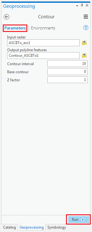
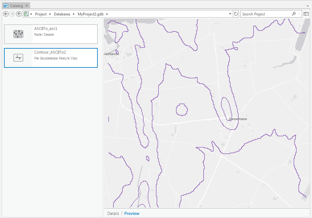
- Click Run to execute the tool. The contour lines with the specified interval are displayed in the map.
Article ID: 000017733
- ArcGIS Pro
Get support with AI
Resolve your issue quickly with the Esri Support AI Chatbot.


Related Information
Discover more on this topic
Search for related information
Find training related to this topic
Explore ideas and give feedback
Get help from ArcGIS experts
Start chatting now