HOW TO
Create a street index for use with Data Driven Pages
Summary
The instructions provided in this article describe two methods used to create a street index for use with Data Driven Pages.
With the introduction of Data Driven Pages at version 10, requests have been made to include the ability to create a street index page. Although this is not available out of the box, there are ways to produce a street index for the map book.
Procedure
This article addresses two methods for adding a street index. Either option may be used, depending on the system environment and user needs.
Use Python
Use the following script tool at ArcGIS Online that processes the data to make the index, GenerateMapBookWithIndexPages_10_v2. Modify the Python script sample as desired.
Use DBF table
- Intersect the streets feature class with the map grid index feature class using the Spatial Join tool.
- In ArcMap, navigate to ArcToolbox > Analysis Tools > Overlay > Spatial Join. The Spatial Join window opens.
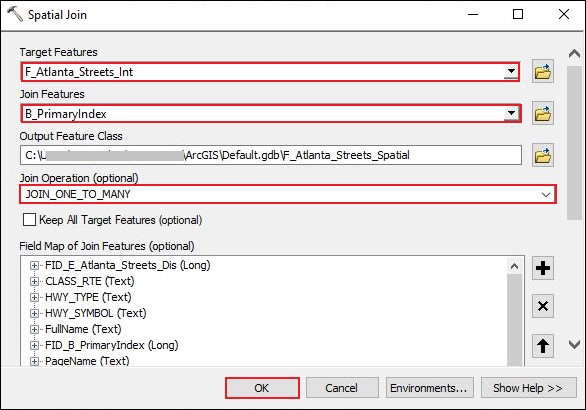
- In the Spatial Join window, fill in the required fields and parameters as follows:
- Target Features: The target streets layer. In this example, the streets layer is F_Atlanta_Streets_Int.
- Join Features: The map grid index layer. In this example, the input is B_PrimaryIndex.
- Join Operation (optional): Select JOIN_ONE_TO_MANY.
- Leave the other parameters as default.
- Click OK to run the tool.
- Add a new text field to the attribute table of the desired field.
- Open the attribute table of the feature class created in Step 1.
- Add a new text field to the attribute table. Refer to ArcMap: Adding fields for instructions.
- Concatenate the street name and page number fields.
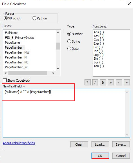
- In the attribute table, right-click the newly created field in Step 2, and click Field Calculator.
- In the Field Calculator window, in the NewTextField section, copy and paste the following to concacenate the street name and the page number fields. In this example, they are FullName and PageNumber:
[FullName]& "" &[PageNumber]).
- Click OK.
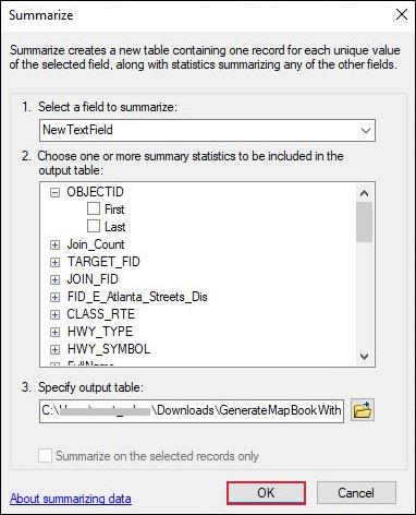
- Summarize the new field to remove duplicates.
- In the attribute table, right-click the newly created field with the generated results from Step 3, and click Summarize.
- In the Summarize window, click OK.
- When prompted with 'Do you want to add the result table in the map?', click Yes.
- In the Table Of Contents, open the created .dbf file in Microsoft Excel and make the desired changes. Print or convert the table to the desired format and add it to the map book.
Note:
This table can be added into the layout using the other add-in, arcpy.mapping map book with Dynamic Graphic Tables, listed in the Related Information links below. Moreover, 'insert object' and 'add table to layout' are options to add static tables to the layout.
Article ID: 000011455
- ArcMap
Get support with AI
Resolve your issue quickly with the Esri Support AI Chatbot.


Related Information
Discover more on this topic
Search for related information
Find training related to this topic
Explore ideas and give feedback
Get help from ArcGIS experts
Start chatting now