HOW TO
Create an index for use with a map series in ArcGIS Pro
Summary
A map series divides a single map layout into multiple pages to display a particular map extent on each page. To create a map series, two datasets are required: an annotation containing the text and a map grid index. A map grid index is a grid of rectangular polygon features used as an index to specify pages in a spatial map series.
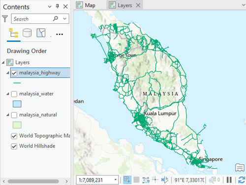
This article provides the workflow to create an index for use with a map series. In this workflow, an index is created for highways in Malaysia as an example.
Procedure
- Open the ArcGIS project with the feature layer.
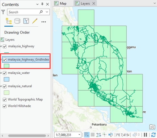
- Create a map grid index using the Grid Index Features tool. The map grid index feature class is created. Rename the feature class if necessary.
- Intersect the feature layer with the map grid index feature class using the Spatial Join tool.
- In the Geoprocessing pane, search for and click the Spatial Join tool.
- In the Spatial Join geoprocessing pane, for Target Features, specify the feature layer. In this example, the malaysia_highway feature layer is specified.
- For Join Features, specify the map grid index feature class.
- For Join Operation, select Join one to many from the drop-down menu.
- Leave the other parameters at default and click Run.
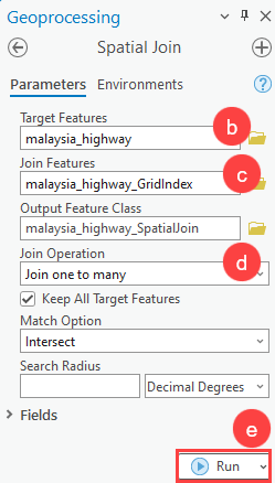
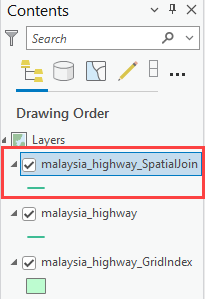
A new feature class, malaysia_highway_SpatialJoin, is created.
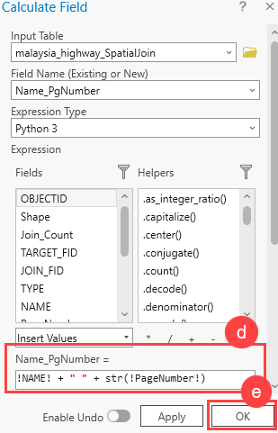
- Concatenate the values in the NAME and PageNumber fields.
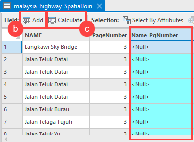
- Open the attribute table of the new spatial join feature class.
- Click Add to add a new text field. In this example, Name_PgNumber is added.
- Select the Name_PgNumber field and click Calculate.
- In the Calculate Field window, under Expression, type the following expression:
!<Name_Field>! + " " + str(!PageNumber!)
- Click OK.
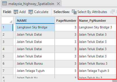
The values in the NAME and PageNumber fields are concatenated in the Name_PgNumber field.
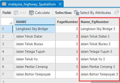
- Remove the duplicate data in the Name_PgNumber field using the Delete Identical tool.
Note:
The Delete Identical tool permanently deletes the duplicated data. To enable undo, toggle the Enable Undo option in the Delete Identical geoprocessing pane before running the tool.
The duplicate data are removed from the Name_PgNumber field.
Article ID: 000028107
- ArcGIS Pro 3 0
- ArcGIS Pro 2 8 x
- ArcGIS Pro 2 7 x
- ArcGIS Pro 2 x
Get support with AI
Resolve your issue quickly with the Esri Support AI Chatbot.


Related Information
Discover more on this topic
Search for related information
Find training related to this topic
Explore ideas and give feedback
Get help from ArcGIS experts
Start chatting now