HOW TO
Create multiline labels in ArcGIS Online Map Viewer
Summary
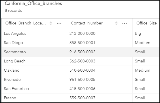
In ArcGIS Online Map Viewer, multiline labels can be created using the Arcade custom expression builder. In this article's example, the California_Office_Branches layer contains information on the branches in California, as shown in the attribute table below.
Note:
ArcGIS Online Map Viewer Classic does not support multiline labels.
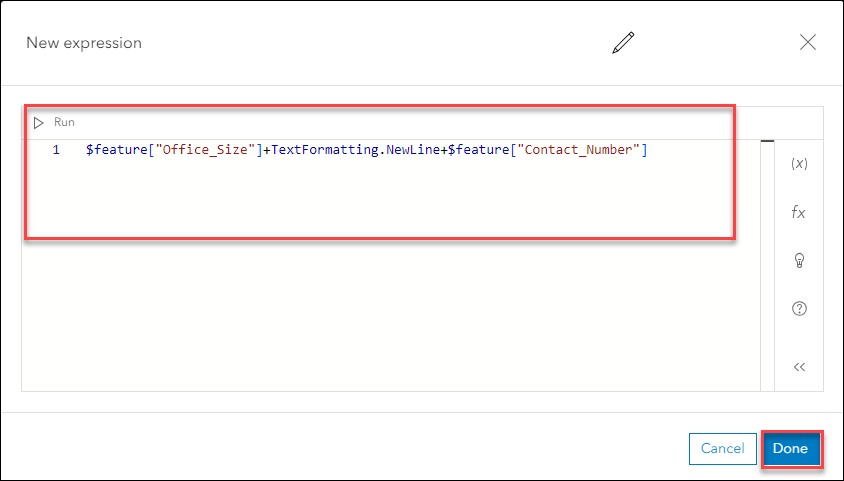
The expression below is used to create a label displaying the Office_Size and Contact_Number field values on two separate lines for each office.
Note:
The TextFormatting.NewLine constant inserts a line break between the two fields.
$feature["Office_Size"]+TextFormatting.NewLine+$feature["Contact_Number"]
Procedure
- In ArcGIS Online, open the layer in Map Viewer and enable labeling. For instructions, refer to Steps 1 through 6 of this help document: ArcGIS Online: Apply labels.
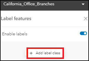
- In the Label features pane, click Add label class.
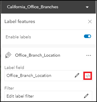
- Under Label field, click the Use expression
 icon.
icon.
- In the editor window, in the expression box, highlight the content and press Delete to clear the box.
- In the editor window, configure the expression below.
- Replace <field_name1> with the name of the field to be displayed in the first line of the label and <field_name2> with the name of the field to be displayed in the second line of the label. In this example, <field_name1> and <field_name2> was replaced by Office_Size and Contact_Number.
$feature["<field_name1>"]+TextFormatting.NewLine+$feature["<field_name2>"]
Note:
Add +TextFormatting.NewLine+$feature["<field_name>"] to the code specified to add a line break for the subsequent field label.
- Click Done.
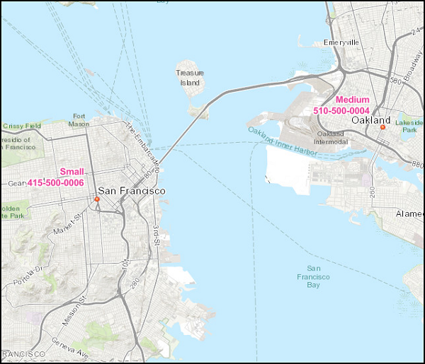
The map below displays the office branches in California labeled with their respective office sizes and contact numbers on separate lines.
Article ID: 000025694
- ArcGIS Online
Get support with AI
Resolve your issue quickly with the Esri Support AI Chatbot.


Related Information
Discover more on this topic
Search for related information
Find training related to this topic
Explore ideas and give feedback
Get help from ArcGIS experts
Start chatting now