PROBLEM
There are three different kinds of elevation or height values used in GIS. How can you tell them apart?
Description
There are three different kinds of elevation values that can be used in GIS, orthometric, ellipsoidal, and geoidal.
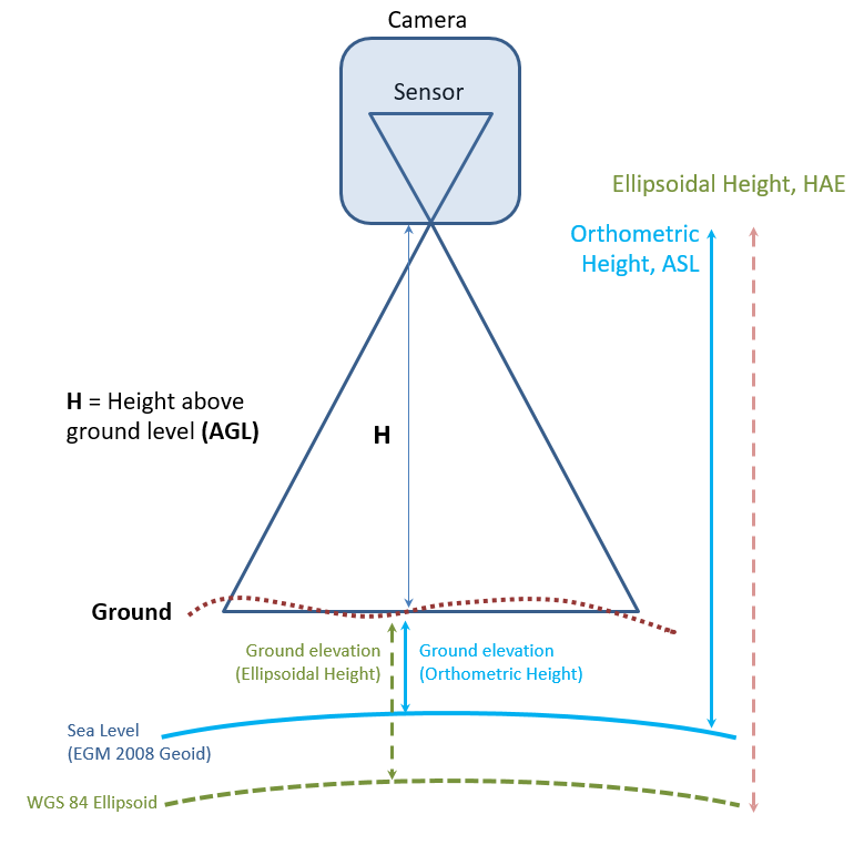
- Orthometric Heights are what we think of as elevation - Mr. Everest is 29,029 feet high, which is an orthometric height. In the diagram below, this is referred to as Topography.
- An ellipsoidal height is the elevation of the calculated spheroid you are using in a particular location - the green line in the below diagram. To visualize this, you can think of it as being an approximation of Mean Sea Level - not mathematically correct but semi-accurate and easy to remember.
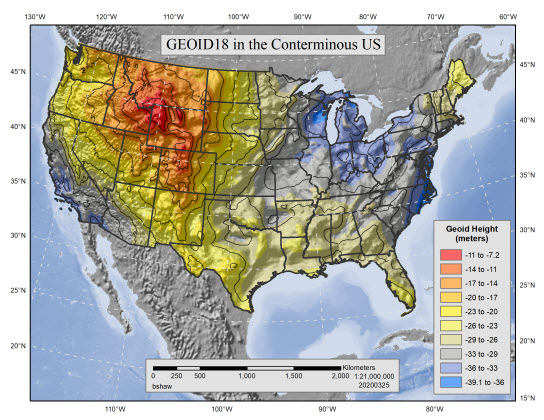
- Geoidal heights are the gravimetric potential of the surface in a particular location. In North America, the geoidal heights are usually between -27 meters and -38 meters.
The image illustrates how these different "height" measurements relate to one another when considering a GPS sensor mounted on a drone.
Cause
There are three kinds of elevation values, orthometric, ellipsoidal, and geoidal heights. Just because the numeric value isn't what the user is expecting, doesn't mean it's wrong.
- Orthometric Heights are what we think of as elevation - Mr. Everest is 29,029 feet high, that is an orthometric height. In the diagram above, this is referred to as the Ground (the ground surface).
- An ellipsoidal height is the elevation of the calculated spheroid you are using in a particular location - the green line in the above diagram. To visualize this, you can think of it as being an approximation of Mean Sea Level - not mathematically correct but semi-accurate and easy to remember.
- Geoidal heights are the gravimetric potential of the surface in a particular location. This varies due differences in density of the earth from place-to-place. For example, iron-rich rocks, such as basalt, have higher density than silica-rich rocks, such as granite. Gravity affects sea level, therefore orthometric height may be thought of as the "height above sea level corrected for gravity".
Solution or Workaround
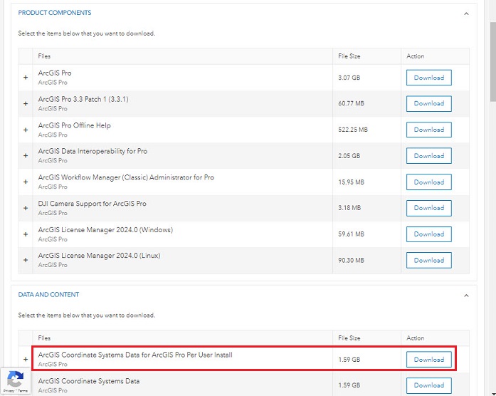
There are numerous options in ArcGIS Pro to transform vertical height systems, or units, to other systems. To perform these vertical transformations, download and install the "ArcGIS Coordinate Systems Data for ArcGIS Pro Per User Install" from My Esri, as shown in the screenshot below:
Orthometric heights for the United States are the North American Vertical Datum (NAVD88), which can measure HEIGHT or DEPTH, with units of us_survey_feet, International_feet, or meters. These vertical coordinate systems (VCS) are local - meaning that they refer to a limited geographic area.
Ellipsoidal (Spheroidal) heights refer to the name of the datum, and the Vertical ellipsoidal coordinate system refers to the datum, such as VCS_WGS_1984_ VCS_NAD_1983_2011, or VCS_NAD_1983. These may apply to the entire earth, such as VCS_WGS_1984, or a local VCS such as New Zealand Vertical Datum 2016 (NZVD2016).
Geoidal vertical coordinate systems refer to the name of the geoid, such as EGM96, EGM2008 or WGS_1984_geoid, and are defined for the entire earth.
Transformations are available between some of these height systems or to convert between vertical units.
Note:
A source of confusion is that applying a vertical transformation to the data does NOT change the values in the field in the attribute table.  To have the new vertical units display as an Attribute for the data, one method for vector data is to run the Add XY Coordinates Tool. If the data is 3D this will add X, Y and Z coordinates for the point to the attribute table.
Refer to lists linked to the Knowledge article: Select the correct geographic (datum) transformation when projecting between datums.
Article ID: 000032750
- ArcGIS Pro
Get support with AI
Resolve your issue quickly with the Esri Support AI Chatbot.


Related Information
Discover more on this topic
Search for related information
Find training related to this topic
Explore ideas and give feedback
Get help from ArcGIS experts
Start chatting now