PROBLEM
Unable to run the Connect Origins to Destinations tool in ArcGIS Online Map Viewer Classic
Description
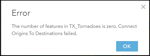
In some cases, attempts to run the Connect Origins to Destinations tool in ArcGIS Online Map Viewer Classic fail, and return the following error message:
Error:
The number of features in <feature_layer> is zero. Connect Origins To Destinations failed.
Cause
- The ArcGIS Online subscription has negative credits.
- The feature layers contain null or empty geometries.
- The 'Use current map extent' option is enabled in the Connect Origins to Destinations tool when features are not within the current map extent.
Solution or Workaround
Use one of the methods below to resolve the issue.
Ensure the ArcGIS Online subscription has sufficient credits
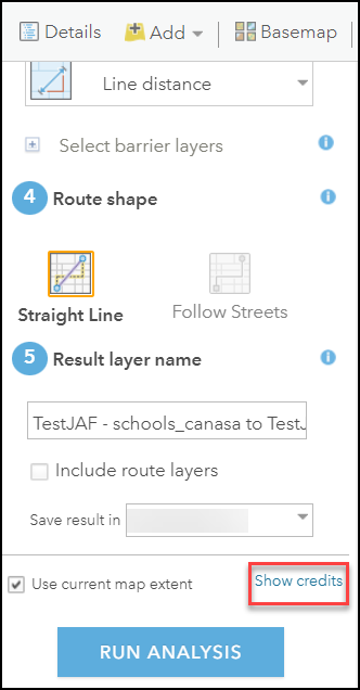
Transaction-based tools such as geocoding, GeoEnrichment, image analysis, and spatial analysis tools are charged based on the number of records and the generated output. Estimate the number of credits required to run the analysis tool in Map Viewer Classic by clicking the Show credits button before running the tool. Refer to ArcGIS Online: Credits by capability for instructions and more information. Purchase additional credits or contact Esri Customer Service for assistance.
Run the Check Geometry and Repair Geometry tools
In ArcGIS Pro, run the Check Geometry (Data Management) and Repair Geometry (Data Management) tools before republishing the map. Refer to ArcGIS Pro: Check Geometry (Data Management) and ArcGIS Pro: Repair Geometry (Data Management) for instructions and more information.
Use the Replace Geometry tool
In ArcGIS Pro, use the Replace Geometry tool to replace features with invalid or missing geometry before republishing the map. Refer to ArcGIS Pro: Replace feature geometry for instructions and more information.
Add data with location fields
In ArcGIS Online, add data with location fields to run the Connect Origins to Destinations tool. Refer to ArcGIS Online: Add items for instructions and more information. In this example, a new CSV file with location fields is added to ArcGIS Online.
- Log in to ArcGIS Online using the organizational account.
- Click the Content tab > My Content > New item.
- In the New item window, drag and drop the CSV file or click the Your device option to select the required file.
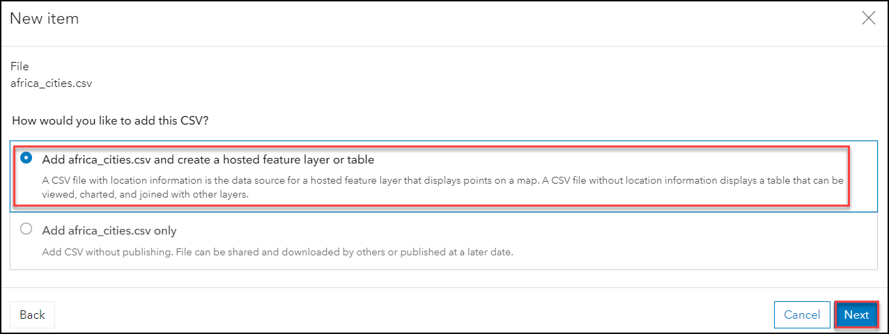
- Select the Add <file> and create a hosted feature layer or table option under How would you like to add this CSV? and click Next.
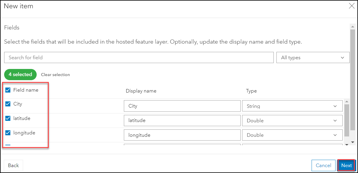
- Select the fields to be included in the hosted feature layer. Click Next.
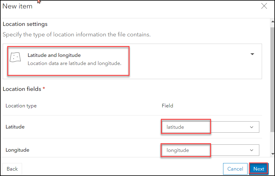
- In the Location settings window, select the type of location information the file contains. In this example, the Latitude and longitude option is selected.
- Under Location fields, select the appropriate fields for Latitude and Longitude. Click Next.
- Fill in the Title and select the folder to save the item. Optionally, fill in the Categories, Tags, and Summary. Click Save.
Uncheck the "Use current map extent" option or adjust the map extent
Uncheck the option at the bottom of the Connect Origins to Destinations tool to "Use current map extent" or adjust the map extent so that the points being analyzed are within the extent, as only features in the visible extent are used when this option is enabled.
Article ID: 000027303
- ArcGIS Online
- ArcGIS Pro 2 8 x
- ArcGIS Pro 2 x
Get support with AI
Resolve your issue quickly with the Esri Support AI Chatbot.


Related Information
Discover more on this topic
Search for related information
Find training related to this topic
Explore ideas and give feedback
Get help from ArcGIS experts
Start chatting now