HOW TO
Geocode addresses from an imported CSV file in ArcGIS Online
Summary
Geocoding in ArcGIS Online enables street addresses to be converted and displayed as point features in Map Viewer. This article describes how to geocode addresses from an imported CSV file in ArcGIS Online.
Note:
Geocoding in ArcGIS Online requires an organizational account and consumes credits. Refer to ArcGIS Online: Understand credits for more information.
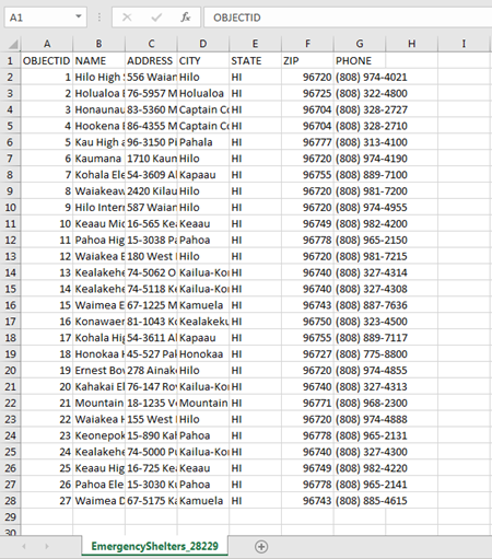
The image below shows a table of addresses in a CSV file format.
Procedure
To geocode addresses from an imported CSV file in ArcGIS Online, follow these steps:
- Click the Add button in ArcGIS Online Map Viewer, and select Add Layer from File from the drop-down list.
- Click Choose File in the Add Layer from File window, and browse to the desired CSV file.
- Select the file and click Open.
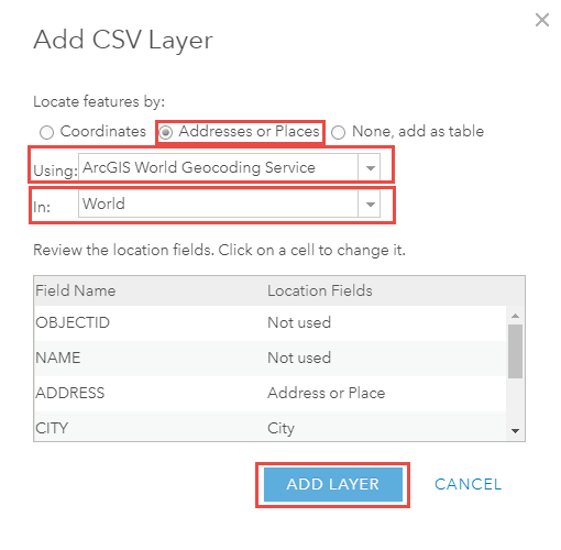
- Click Import Layer in the Add Layer from File window, and the Add CSV Layer dialog box opens.
- Select the Addresses or Places option for Locate features by.
Note:
The ArcGIS World Geocoding Service only recognizes address fields in address tables when geocoding.
Refer to ArcMap: Understanding address locator styles as a guide to constructing addresses.
- Select ArcGIS World Geocoding Service from the Using drop-down list.
Note:
By default, ArcGIS Online uses the ArcGIS World Geocoding Service to geocode. Refer to ArcGIS Online: Configure utility services to add other geocoding services.
- Select World from the In drop-down list, and click ADD LAYER.
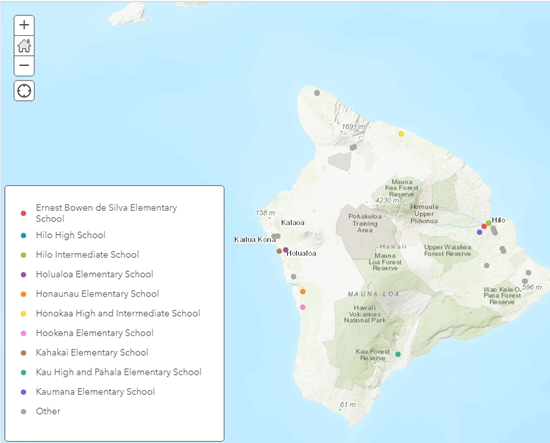
The image below shows the addresses from the imported CSV file are geocoded and displayed in Map Viewer.
Article ID: 000021263
- ArcGIS Online
Get support with AI
Resolve your issue quickly with the Esri Support AI Chatbot.


Related Information
Discover more on this topic
Search for related information
Find training related to this topic
Explore ideas and give feedback
Get help from ArcGIS experts
Start chatting now