PROBLEM
The Print widget does not honor layer information and displays incorrectly in ArcGIS Experience Builder
Description
When attempting to print a template using the Print widget in ArcGIS Experience Builder, the Print widget does not honor the layer information and displays incorrectly. In this example, the resulting print appears as a blank globe without any data, although the map displays properly in the web experience. Map elements, such as legends and scalebars, are also not presented on the template. Despite configuring the map printing extents to show the associated map layers and features, the map is displayed in an unexpected projection.
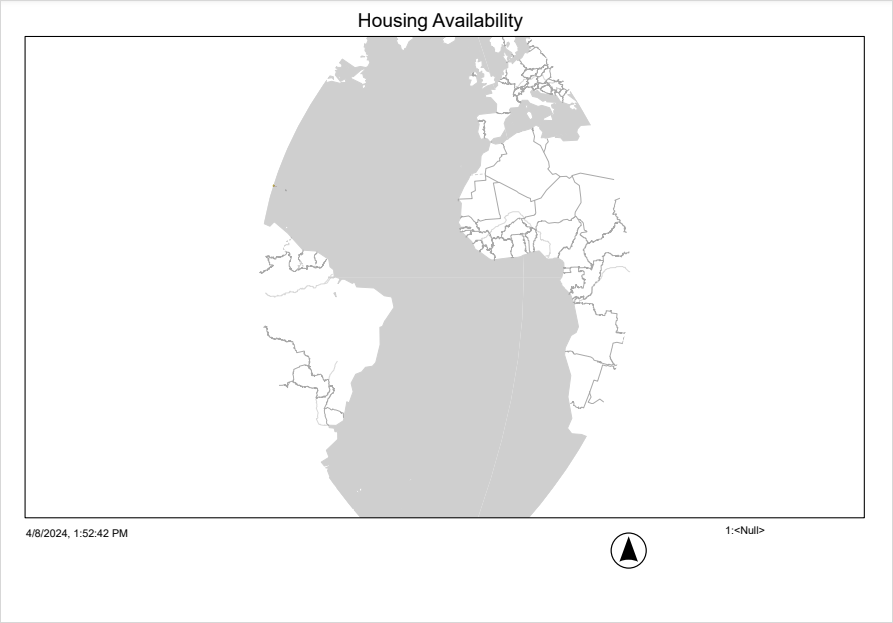
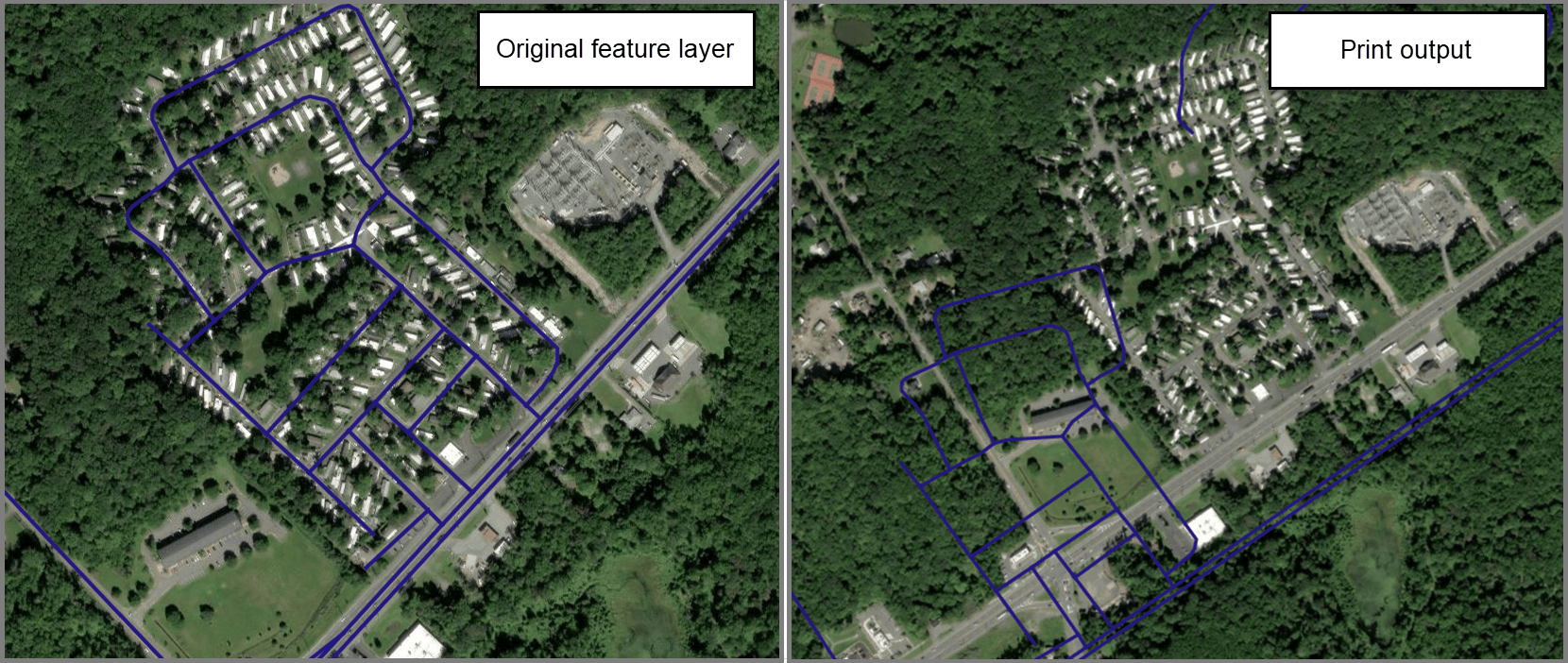
In some cases, the feature layers are shifted and drawn in another location on the basemap (on the print template), as shown in the map below.
Cause
The output spatial reference is not set to the default projection in ArcGIS Online or any appropriate projection compatible with the basemap. By default, the output spatial reference for the Print widget in ArcGIS Experience Builder is the WGS 1984 Web Mercator Auxiliary Sphere with the well-known ID (WKID) 102100. Due to known or unknown changes to the output spatial reference, the generated print output may display a shift in projection during printing.
Solution or Workaround
- Open the ArcGIS Experience Builder web experience.
- Click the Print widget to open the Print pane.
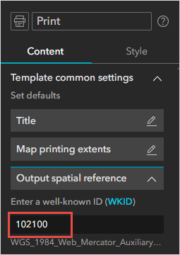
- In the Print pane, on the Content tab, expand Template common settings.
- Click Expand
 next to Output spatial reference and specify the default WKID 102100. Alternatively, choose an appropriate output spatial reference based on the compatibility of the basemap. Refer to ArcGIS REST APIs: Using spatial references for more information. Some projections can display accurately and honor the data if they have similar projections as ArcGIS Online.
- Save, preview, and publish the experience.
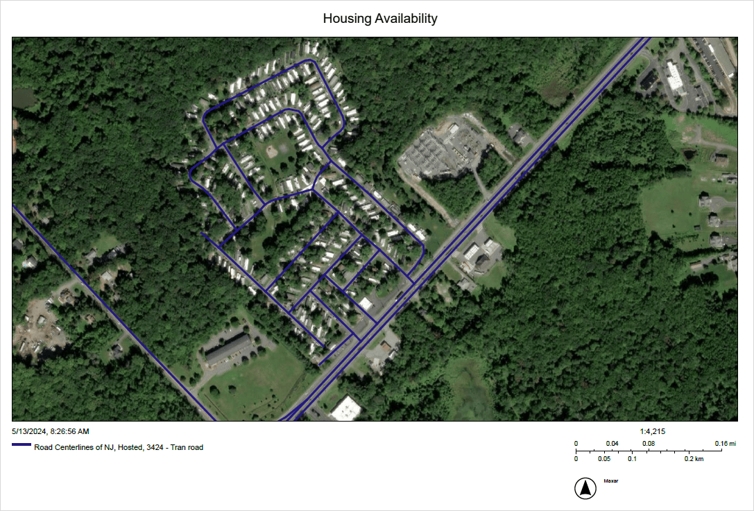
The map below shows the layers, legend, and other map elements displaying as expected on the print template when the appropriate output spatial reference for the Print widget is configured.
Article ID: 000032214
- ArcGIS Experience Builder
Get support with AI
Resolve your issue quickly with the Esri Support AI Chatbot.


Related Information
Discover more on this topic
Search for related information
Find training related to this topic
Explore ideas and give feedback
Get help from ArcGIS experts
Start chatting now