PROBLEM
The output raster pixel type is changed to a signed raster when running the Raster Calculator tool
Description
In ArcGIS Pro, when using the Raster Calculator tool with an analysis mask (environment setting) and selecting signed and unsigned raster data as the inputs, the pixel type of the output raster is changed to signed. For example, when inserting a signed and an unsigned 8-bit raster data in the Map Algebra expression of the Raster Calculator tool and selecting an analysis mask, the output raster pixel type is fixed to a signed 8-bit raster. In some instances, the output raster displays gaps in certain areas.
Cause
This is a known issue. Refer to BUG-000124939 for more information.
Solution or Workaround
Use one of the following workarounds to solve this issue:
Convert the pixel type of the input raster data to unsigned
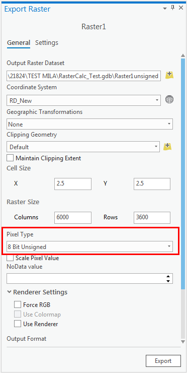
To obtain an unsigned raster data output, convert the pixel type of the signed raster inputs to unsigned before running the Raster Calculator tool. To do this, refer to the steps provided in ArcGIS Pro: Export or convert raster datasets. In the Export Raster pane, set the Pixel Type to unsigned. For example, select 8 Bit Unsigned to change an 8-bit signed raster to an 8-bit unsigned raster. Do this for each signed raster input.
Use the built-in geoprocessing toolset instead of the Raster Calculator tool
Note:
This option requires a Spatial Analyst license.
Instead of using the Raster Calculator tool to build and execute Map Algebra expressions on the raster data, use geoprocessing tools such as the Is Null (Math toolset) and Con (Conditional toolset) tools to get the desired output raster. Refer to Spatial Analyst toolsets for more sets of spatial analysis and modeling tools for raster data.
Article ID: 000021824
- ArcGIS Pro 2 x
Get support with AI
Resolve your issue quickly with the Esri Support AI Chatbot.


Related Information
Discover more on this topic
Search for related information
Find training related to this topic
Explore ideas and give feedback
Get help from ArcGIS experts
Start chatting now