PROBLEM
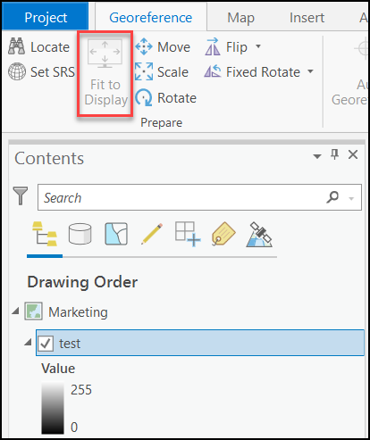
The Fit To Display tool is not available on the Georeference tab in ArcGIS Pro
Description
The Fit To Display tool enables the georeferenced raster to be placed into the current map extent display. In some instances, the tool is not available on the Georeference tab in ArcGIS Pro.
Cause
- The ArcGIS Pro project is corrupted.
- The raster dataset is in an unsupported format.
- The coordinate system of the map does not match the coordinate system of the raster dataset.
- There are multiple active georeferencing sessions at a time.
Solution or Workaround
Depending on the cause, use one of the options below to resolve the issue.
Create a new project
In ArcGIS Pro, create a new project and add the existing raster layers. Refer to ArcGIS Pro: Create a project and ArcGIS Pro: Add layers to a map or scene for steps to do so.
Add new raster dataset with a supported format
In ArcGIS Pro, remove the corrupted raster layer or the raster dataset with an unsupported format. Add a new raster dataset with a supported format. Refer to ArcGIS Pro: Raster file formats for more information.
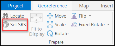
Use the Set SRS tool
In ArcGIS Pro, click the Set SRS tool from the Prepare group on the Georeference tab to set the coordinate system of the map. The tool enables the coordinate system of the map to match the coordinate system of the raster dataset. Refer to ArcGIS Pro: Georeference a raster to x,y coordinates for more information.
Close other active georeferencing sessions
In ArcGIS Pro, close other active georeferencing sessions and ensure only one active georeferencing session at a time. On the Georeference tab, in the Close group, click Close Georeference to end the active georeferencing session.
Article ID: 000027195
- ArcGIS Pro 2 8 x
- ArcGIS Pro 2 7 x
- ArcGIS Pro 2 x
Get support with AI
Resolve your issue quickly with the Esri Support AI Chatbot.


Related Information
Discover more on this topic
Search for related information
Find training related to this topic
Explore ideas and give feedback
Get help from ArcGIS experts
Start chatting now