PROBLEM
Some tools in the Measure toolset are disabled in ArcGIS Pro
Description
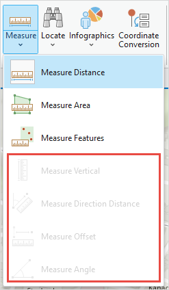
In ArcGIS Pro, when attempting to measure the area or surface of a map, some tools in the Measure toolset in the Inquiry group are disabled, as shown in the image below.
Cause
The Measure Direction Distance tool, Measure Offset tool, and Measure Angle tool are disabled because the map in an ArcGIS Pro project uses the geographic coordinate system (GCS). Refer to ArcGIS Pro: Coordinate systems, map projections, and transformations for more information. To identify the current coordinate system of the map, refer to ArcGIS Blog: Geographic vs Projected Coordinate Systems for more information. The Measure Vertical tool is disabled because the tool is only available in 3D scene instead of a 2D map.
Solution or Workaround
Enabling the Measure Direction Distance tool, Measure Offset tool, and Measure Angle tool
The map must be set to a projected coordinate system (PCS) to enable the Measure toolset in ArcGIS Pro. The workflow below demonstrates the steps to change the coordinate system of a map from geographic coordinate system (GCS) to projected coordinate system (PCS).
- Open the project in ArcGIS Pro.
- In the Contents pane, right-click Map and select Properties.
- In the Map Properties window, click the Coordinate Systems tab.
- Under XY Coordinate Systems Available, expand Projected Coordinate System and select the desired coordinate system based on the location zone. In this example, the projected coordinate system selected is WGS 1984 UTM Zone 54N.
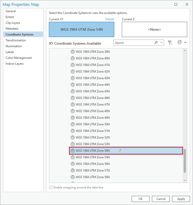
- Click Apply > OK.
- On the ribbon, click the Map tab. In the Inquiry group, click the Measure drop-down menu to select the desired measure tool.
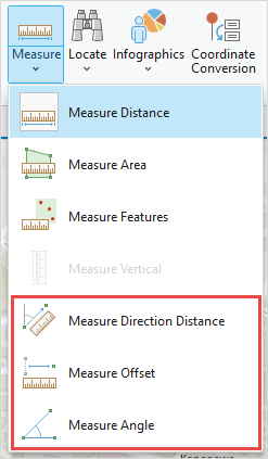
The image below shows the Measure toolset is enabled after changing the coordinate system of the map in ArcGIS Pro.
Enabling the Measure Vertical tool
Convert the map to a scene. Refer to ArcGIS Pro: Create a scene from the map for more information.
Article ID: 000032709
- ArcGIS Pro 3 1
- ArcGIS Pro 3 3
- ArcGIS Pro 3 2
Get support with AI
Resolve your issue quickly with the Esri Support AI Chatbot.


Related Information
Discover more on this topic
Search for related information
Find training related to this topic
Explore ideas and give feedback
Get help from ArcGIS experts
Start chatting now