HOW TO
Identify common roads from intersections in ArcGIS Pro
Summary
A common road is a road segment that can intersect multiple other roads and is publicly accessible. Identifying the intersections is crucial for maintaining accurate spatial relationships between road features, supporting route optimization, and infrastructure planning. This article describes the workflow to identify common roads from intersections in ArcGIS Pro.
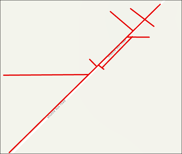
The image below illustrates the line feature layer, highlighting roads with multiple intersections.
Procedure
- Open the ArcGIS Pro project with the line feature layer.
Note:
For instructions to find and use the geoprocessing tool, refer to ArcGIS Pro: Find a geoprocessing tool.
- Create a new point feature layer from the line feature layer using the Feature Vertices To Points tool.
- In the Feature Vertices To Points pane, for Input Features, select the line feature layer from the drop-down list.
- For Output Feature Class, specify a name and location.
- For Point Type, select Both start and end vertex from the drop-down list.
- Click Run.
- Use the Select By Location tool to select point features that intersect with the line feature layer.
- On the Map tab, under the Selection group, click Select By Location.
- In the Select By Location window, for Input Features, select the line feature layer from the drop-down list.
- For Relationship, select Completely contains from the drop-down list.
- For Selecting Features, select the point feature layer created in Step 2 from the drop-down list.
- Click Apply > OK.
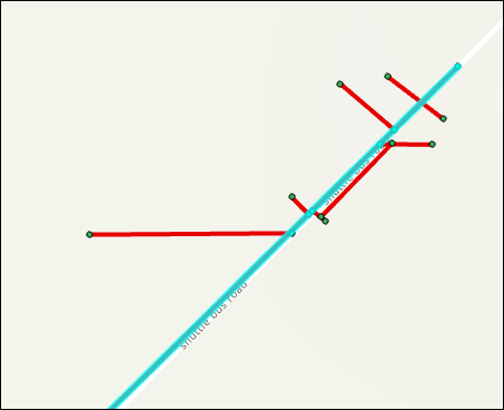
The map shows the common road identified from intersecting roads.
Note:
Optionally, to save the selected line as a new feature layer, right-click the line feature layer in the Contents pane and click Selection > Make Layer From Selected Features.
Article ID: 000034872
- ArcGIS Pro 3 3
- ArcGIS Pro 3 2
- ArcGIS Pro 3 4
Get support with AI
Resolve your issue quickly with the Esri Support AI Chatbot.


Related Information
Discover more on this topic
Search for related information
Find training related to this topic
Explore ideas and give feedback
Get help from ArcGIS experts
Start chatting now